Upper Dolpo Trek

Facts You Need For 23 Days Upper Dolpo Trek

Starting/Ending Point

Kathmandu / Kathmandu

Duration

23 Days

Max. Altitude

5,350 m / 17,552 ft (Kang La Pass)

Accommodation

Teahouses and tented camps

Activity Per Day

5 to 8 hours

Best Season

January, February, March, April, May, September, October, November, December

Group Size

1 - 20

Meals Included

Breakfast, lunch, and dinner

Difficulty

Challenging

Activity

Trekking in Nepal

Nature Of Trek

Camping and teahouse trekking

Transportation

Kathmandu–Nepalgunj–Juphal by domestic flights and Juphal–Dunai by private 4WD vehicle

Overview of 23 Days Upper Dolpo Trek

The 23-day Upper Dolpo Trek in Nepal is a high-altitude expedition in the restricted region of western Nepal, taking trekkers through Shey Phoksundo National Park, over the 5,350 m Kang La Pass, and into Tibetan Buddhist villages like Shey Gompa and Dho Tarap. Although fewer people visit Upper Dolpo, the trek is known for Himalayan views of Dhaulagiri Range (8,167 m), Crystal Mountain (5,100 m), the Kanjirowa Range (6,883 m), and regional peaks such as Putha Hiunchuli (7,246 m), Mukot Himal (6,058 m), and Buddha Himal (6,672 m).

Upper Dolpo lies in the rain-shadow zone behind the Dhaulagiri mountain range. Historically isolated from modern developments, the region preserves Tibetan culture and Bon traditions. According to Nepal Tourism Board Statistics, Shey Phoksundo National Park receives fewer than 1,000 foreign visitors annually, compared to over 50,000 in the Annapurna region. This low visitor volume makes sure that trails are culturally preserved.

American author Peter Matthiessen, at age 46 during his 1973 expedition, documented his journey to Shey Gompa in his book “The Snow Leopard“. He observed the isolation of the region, writing: “Once again I feel like I have landed on another planet.”

Because Upper Dolpo is classified as a restricted border zone by the Nepal Department of Immigration, foreign trekkers must obtain a Restricted Area Permit and travel with a licensed guide. The trek starts at about 150 m in Nepalgunj and reaches 5,350 m at Kang La Pass, so good physical fitness and sufficient time to adjust to the high altitude are essential. If you need any help preparing for the trek, feel free to contact the Out Bound Trek team.

Highlights for 23 Days Upper Dolpo Trek

  • Visit Shey Phoksundo Lake (3,612 m), the deepest lake of Nepal.
  • Cross high mountain passes such as Jeng La Pass (5,110 m) to witness the beautiful Dhaulagiri range.
  • Explore Shey Gompa, an 11th-century Tibetan Buddhist monastery located at the base of Crystal Mountain.
  • Trek through Dho Tarap (4,040 m), recognized as one of the highest human settlements in the world.
  • Observe wildlife like blue sheep, Himalayan tahr, and snow leopards within Shey Phoksundo National Park.
  • Experience pre-Buddhist Bon religion traditions and visit small monasteries in Namduna and Saldang.
  • Experience a full camping adventure, supported by licensed guides, porters, and field cooks.

Daily Altitude Progress During The 23 Days Upper Dolpo Trek

Day 01: Fly from Kathmandu (1,324 m / 4,341 ft) to Nepalgunj (150 m / 490 ft)

  • Altitude Gain: 0 m / 0 ft
  • Altitude Loss: 1,174 m / 3,851 ft

Day 02: Fly to Juphal (2,499 m / 8,200 ft), then drive to Dunai (2,140 m / 7,020 ft)

  • Altitude Gain: 1,990 m / 6,529 ft
  • Altitude Loss: 0 m / 0 ft

Day 03: Trek from Dunai (2,140 m / 7,020 ft) to Ankhe (2,896 m / 9,499 ft)

  • Altitude Gain: 756 m / 2,479 ft
  • Altitude Loss: 0 m / 0 ft

Day 04: Trek from Ankhe (2,896 m / 9,499 ft) to Renje (3,104 m / 10,183 ft)

  • Altitude Gain: 208 m / 684 ft
  • Altitude Loss: 0 m / 0 ft

Day 05: Trek from Renje (3,104 m / 10,183 ft) to Shey Phoksundo Lake (3612 m / 11,850 ft)

  • Altitude Gain: 508 m / 1,667 ft
  • Altitude Loss: 0 m / 0 ft

Day 06: Rest & Exploration day

  • Altitude Gain: –
  • Altitude Loss: –

Day 07: Trek from Shey Phoksundo Lake (3612 m / 11,850 ft) to Phoksundo Khola (3,507 m / 11,505 ft)

  • Altitude Gain: 0 m / 0 ft
  • Altitude Loss: 105 m / 345 ft

Day 08: Trek from Phoksundo Khola (3,507 m / 11,505 ft) to Phoksundo Bhanjyang (3,910 m / 12,829 ft)

  • Altitude Gain: 403 m / 1,324 ft
  • Altitude Loss: 0 m / 0 ft

Day 09: Trek from Phoksundo Bhanjyang (3,910 m / 12,829 ft) to Shey Gompa (4,200 m / 13,780 ft)

  • Altitude Gain: 290 m / 951 ft
  • Altitude Loss: 0 m / 0 ft

Day 10: Rest & Exploration day

  • Altitude Gain: –
  • Altitude Loss: –

Day 11: Trek from Shey Gompa (4,200 m / 13,780 ft) to Namduna (4,400 m / 14,435 ft)

  • Altitude Gain: 200 m / 655 ft
  • Altitude Loss: 0 m / 0 ft

Day 12: Trek from Namduna (4,400 m / 14,435 ft) to Saldang (3,620 m / 11,880 ft)

  • Altitude Gain: 0 m / 0 ft
  • Altitude Loss: 780 m / 2,555 ft

Day 13: Trek from Saldang (3,620 m / 11,880 ft) to Yangtze Gompa (4,960 m / 16,272 ft)

  • Altitude Gain: 1,340 m / 4,392 ft
  • Altitude Loss: 0 m / 0 ft

Day 14: Trek from Yangtze Gompa (4,960 m / 16,272 ft) to Sibu (4,560 m / 14,930 ft)

  • Altitude Gain: 0 m / 0 ft
  • Altitude Loss: 400 m / 1,342 ft

Day 15: Trek from Sibu (4,560 m / 14,930 ft) to Jeng La Phedi (4,900 m / 16,072 ft)

  • Altitude Gain: 340 m / 1,142 ft
  • Altitude Loss: 0 m / 0 ft

Day 16: Trek from Jeng La Phedi (4,900 m / 16,072 ft) to Tokyu (4,209 m / 13,810 ft) via Jeng La Pass (5,110 m / 16,765 ft)

  • Altitude Gain: 0 m / 0 ft
  • Altitude Loss: 691 m / 2,262 ft

Day 17: Trek from Tokyu (4,209 m / 13,810 ft) to Dho Tarap (4,040 m / 13,255 ft)

  • Altitude Gain: 0 m / 0 ft
  • Altitude Loss: 169 m / 555 ft

Day 18: Trek from Dho Tarap (4,040 m / 13,255 ft) to Serkam (3,630 m / 11,910 ft)

  • Altitude Gain: 0 m / 0 ft
  • Altitude Loss: 410 m / 1,345 ft

Day 19: Trek from Serkam (3,630 m / 11,910 ft) to Khanigaun (3,150 m / 10,335 ft)

  • Altitude Gain: 0 m / 0 ft
  • Altitude Loss: 480 m / 1,575 ft

Day 20: Trek from Khanigaun (3,150 m / 10,335 ft) to Tarakot (2,537 m / 8,323 ft)

  • Altitude Gain: 0 m / 0 ft
  • Altitude Loss: 613 m / 2,012 ft

Day 21: Trek from Tarakot (2,537 m / 8,323 ft) to Dunai (2,140 m / 7,020 ft)

  • Altitude Gain: 0 m / 0 ft
  • Altitude Loss: 397 m / 1,303 ft

Day 22: Trek from Dunai (2,140 m / 7,020 ft) to Juphal (2,499 m / 8,200 ft)

  • Altitude Gain: 359 m / 1,180 ft
  • Altitude Loss: 0 m / 0 ft

Day 23: Fly to Nepalgunj (150 m / 490 ft), then to Kathmandu (1,324 m / 4,341 ft)

  • Altitude Gain: 1,175 m / 3,854 ft
  • Altitude Loss: 0 m / 0 ft

23 Days Upper Dolpo Trek Itinerary

Day 01 :

Fly from Kathmandu (1,324 m / 4,343 ft) to Nepalgunj (150 m / 492 ft)

Overnight Stay

Nepalgunj

Drive Duration

6-7 hours

Flight Hours

50–60 minutes

Highest Altitude

1,324 m / 4,343 ft (Kathmandu)

Meals

Lunch and Dinner

Accommodation

Hotel

Your Upper Dolpo adventure starts with a domestic flight from Kathmandu to Nepalgunj, the main gateway to western Nepal. Sit on the right side of the aircraft for the best chance to see the Langtang, Manaslu, and Annapurna mountain ranges before the geography changes into the plains of the Terai.

After landing at Nepalgunj at just 150 m above sea level, you will notice a huge change in climate. The city lies close to the India–Nepal border and is one of the warmest places in Nepal. Daytime temperatures reach 35°C to 40°C during the hotter months. You can spend the rest of the day relaxing at your hotel, checking your trekking equipment, and preparing for the early morning flight to Juphal on the following day.

Day 02 :

Fly to Juphal (2,500 m / 8,202 ft), then drive to Dunai (2,850 m / 9,350 ft)

Overnight Stay

Dunai

road

Drive Distance

10 km / 6.2 miles

Drive Duration

25–30 minutes

Highest Altitude

2,850 m / 9,350 ft (Dunai)

Meals

Breakfast, Lunch, and Dinner

Accommodation

Teahouse

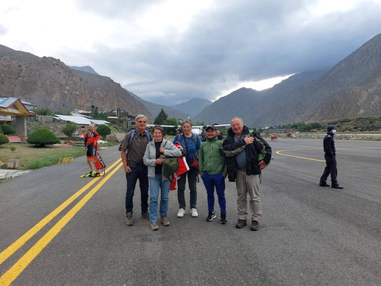
An early morning flight takes you from Nepalgunj to Juphal, the main air gateway to the Dolpo region. The journey lasts about 25 to 30 minutes on a small twin-propeller aircraft that lands on the mountain airstrip at Juphal. Baggage limits are strict on this route, so you should keep your main duffel within 10 kg and your daypack within 5 kg. After landing, you meet your trekking crew, have lunch, and start the drive toward Dunai.

A 45-minute to 1.5-hour drive on a mountain road beside the Thuli Bheri River brings you to Dunai, the administrative center of Dolpa District. Dunai is the last town with stable electricity, mobile phone coverage, and basic services before you enter the remote areas of Upper Dolpo. Your guide completes the permit registration at the local checkpoint while you have time to rest and prepare for the trek that begins the next day.

Day 03 :

Trek from Dunai (2,850 m / 9,350 ft) to Ankhe (2,130 m / 6988 ft)

Trek Distance

10 km / 6.2 miles

Trek Duration

5–6 hours

Overnight Stay

Ankhe

Highest Altitude

2,900 m / 9,514 ft (Rahagoan)

Meals

Breakfast, Lunch, and Dinner

Accommodation

Teahouse

After breakfast, you leave Dunai and cross a suspension bridge before following the north bank of the Thulo Bheri River. The trail then turns north into the beautiful Phoksundo (Suli Gad) River Valley, where forests of pine and cedar replace the open valley. A short climb brings you to the Kagmara Viewpoint Ridge (2,499 m), where you can capture the Kagmara Peak. The trek continues through Dhera Village (2,810 m), which is known for its old walnut trees and seasonal grazing land.

From Dhera, you climb to Rahagaon (2,900 m), a Bhotiya village with stone houses and a small Mastha Gompa devoted to the ancient guardian deity of the valley. The route then descends a forest on stone steps before reaching the village of Ankhe (2,896 m).

Day 04 :

Trek from Ankhe (2,130 m / 6988 ft) to Renje (3,104 m / 10,183 ft)

Trek Distance

10 km / 6.2 miles

Trek Duration

5–6 hours

Overnight Stay

Renje

Highest Altitude

3,104 m / 10,183 ft (Renje)

Meals

Breakfast, Lunch, and Dinner

Accommodation

Teahouse

After leaving Ankhe, you follow the Phoksundo River across blue pine, spruce, and giant bamboo forest. The trail crosses small streams on wooden bridges and continues with frequent climbs and descents through the valley. Some areas are supported by wooden beams that have helped trekkers cross this tough area for many years. Trekking poles can provide extra balance on these narrow passages.

The trail later descends to silver birch and wild rose bushes before reaching Ryajik Village (3,030 m), a settlement surrounded by fields of potatoes and buckwheat. A short walk beside the Phoksundo River takes you to Renje (3,104 m) for an overnight stay.

Day 05 :

Trek from Renje (3,104 m / 10,183 ft) to Shey Phoksundo Lake (3,611 m / 11,847 ft)

Trek Distance

15 km / 9.3 miles

Trek Duration

6–7 hours

Overnight Stay

Shey Phoksundo Lake (Phoksundo)

Highest Altitude

3,611 m / 11,847 ft (Shey Phoksundo Lake)

Meals

Breakfast, Lunch, and Dinner

Accommodation

Teahouse

Today’s trek takes you deeper into Shey Phoksundo National Park as you follow the Phoksundo Khola. After crossing wooden bridges, you reach the point where the Phoksundo Khola joins the Pungmo Khola. From here, the trail climbs up a zigzag path to Polam (3,400 m), a seasonal settlement used by the people of Ringmo. Near the top of the climb, you reach a viewpoint from where you can see 167 m Suligad Waterfall, one of the tallest waterfalls in Nepal.

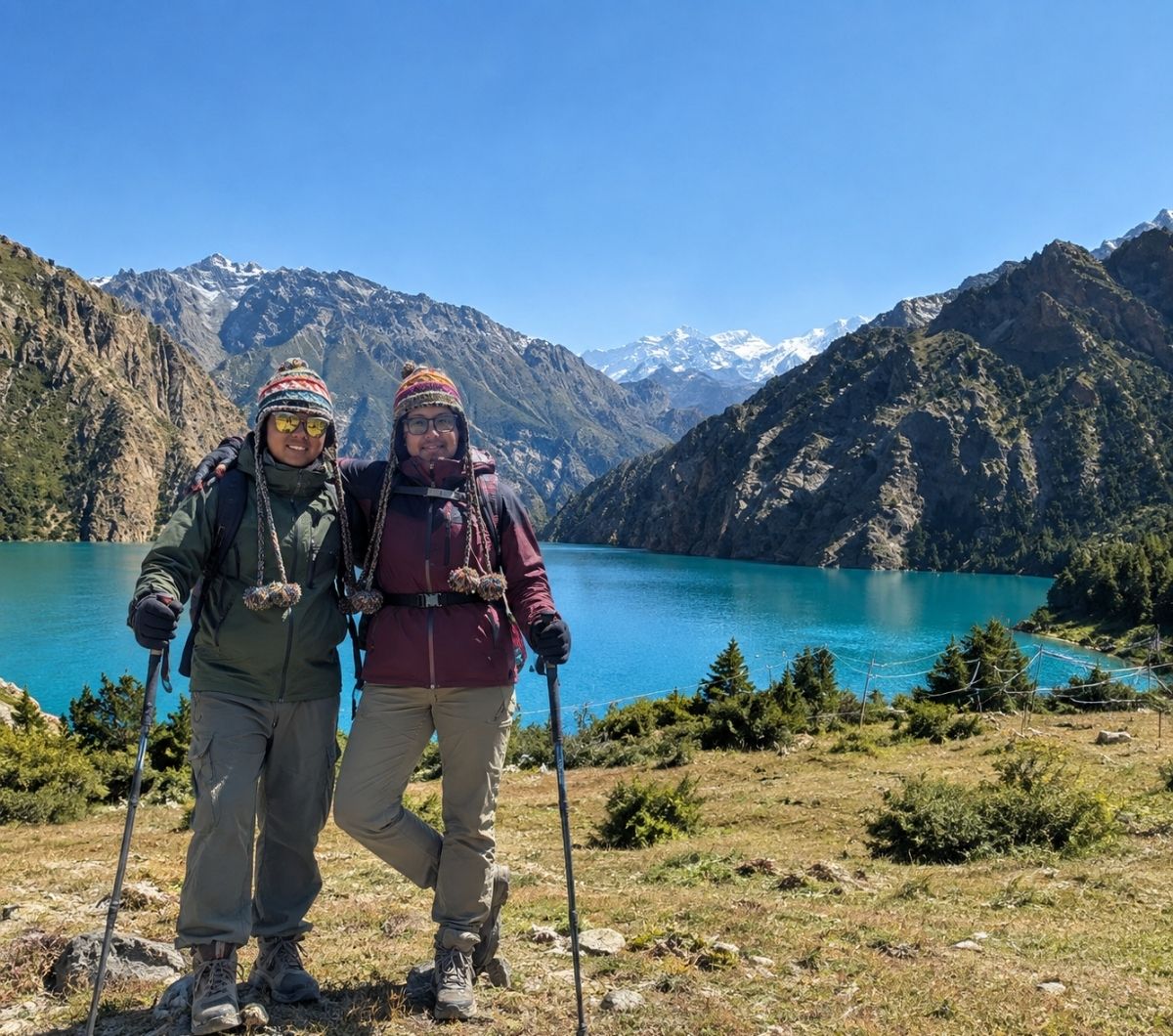
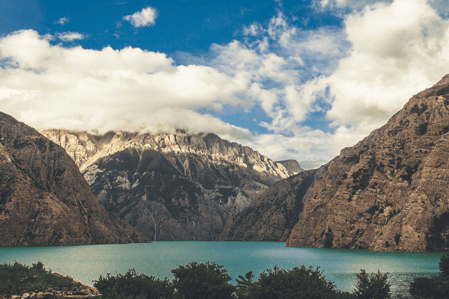
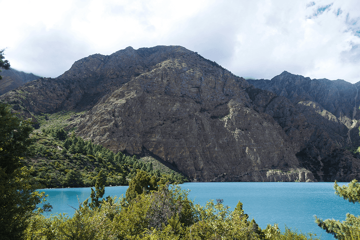
Beyond the waterfall, the trail is less steep, and you can see the blue water of Shey Phoksundo Lake. Continuing on the lakeshore, you arrive at your teahouse beside the lake. From here, the journey enters the cultural center of Upper Dolpo, where the local language, architecture, and customs are connected to the traditions of the ancient Tibetan Plateau.

Day 06 :

Rest & Exploration day

Trek Distance

3–5 km / 1.9–3.1 miles (optional exploration)

Trek Duration

2–3 hours

Overnight Stay

Shey Phoksundo Lake

Highest Altitude

3,611 m / 11,847 ft (Shey Phoksundo Lake)

Meals

Breakfast, Lunch, and Dinner

Accommodation

Teahouse

Today is an important acclimatization day at Shey Phoksundo Lake. Instead of staying at the teahouse all day, you take a short walk to adjust your body to the higher elevation. A one-hour hike on the eastern shore leads to Thasung Tsho Ling Gompa, an 800-year-old Bon monastery that stands above the lake. While visiting the monastery, remember to walk around the chortens in a counter-clockwise direction to respect local Bon traditions.

After visiting the monastery, you return to Ringmo Village to explore one of the oldest settlements of the Upper Dolpo. Depending on the season, local people may be drying chhurpi made from yak milk, spinning yak wool, or working in fields of barley and buckwheat. This visit gives you a better understanding of the daily life and culture that have been preserved in this Himalayan region for centuries.

The afternoon is free for rest beside the shores of Phoksundo Lake. You can wash a few clothes, dry your equipment in the sun, and organize your backpack before the trek continues toward the higher passes of Upper Dolpo. Drink plenty of water or herbal tea throughout the day because the dry mountain air increases fluid loss. Use sunscreen, sunglasses, and a hat, as sunlight is much stronger at this elevation.

Day 07 :

Trek from Shey Phoksundo Lake (3,611 m / 11,847 ft) to Phoksundo Khola (3,507 m / 11,505 ft)

Trek Distance

8 km / 5 miles

Trek Duration

4–5 hours

Overnight Stay

Phoksundo Khola

Highest Altitude

3,612 m / 11,850 ft (Shey Phoksundo Lake)

Meals

Breakfast, Lunch, and Dinner

Accommodation

Camping

After breakfast, you leave the shores of Shey Phoksundo Lake and start one of the most impressive parts of the Upper Dolpo Trek. The trail climbs a cliff above the western side of the lake, where tall rock walls stand on one side, and the turquoise water lies far below on the other. From the highest viewpoint, you can look back at the entire lake and see Ringmo Village surrounded by cliffs and mountains.

You will then drop through forests of blue pine, birch, and Himalayan willow before reaching the Phoksundo Khola. This peaceful campsite is located deep inside Shey Phoksundo National Park, where there are no permanent villages, mobile networks, or modern facilities. From this point onward, you travel into one of the least-visited parts of the Himalayas.

Day 08 :

Trek from Phoksundo Khola (3,507 m / 11,505 ft) to Phoksundo Bhanjyang (3,910 m / 12,829 ft)

Trek Distance

7 km / 4.3 miles

Trek Duration

4–5 hours

Overnight Stay

Phoksundo Bhanjyang

Highest Altitude

3,910 m / 12,829 ft (Phoksundo Bhanjyang)

Meals

Breakfast, Lunch, and Dinner

Accommodation

Tent / Camping

After leaving your campsite at Phoksundo Khola, you follow the glacial valley toward the north. The trail crosses small channels of the Phoksundo Khola on wooden log bridges before reaching the meeting point of two fast-flowing mountain streams. Here, the valley narrows, and the route enters a rocky gorge. Forests disappear at higher elevations and are replaced by juniper shrubs and alpine grass.

As you continue climbing, the gorge opens into an alpine basin surrounded by cliffs and snow-covered peaks. The landforms become more remote as you approach Phoksundo Bhanjyang, also known as the base camp below Kang La Pass.

Day 09 :

Trek from Phoksundo Bhanjyang (3,910 m / 12,829 ft) to Shey Gompa (4,500 m / 14,764 ft)

Trek Distance

10 km / 6.2 miles 

Trek Duration

6–7 hours

Overnight Stay

Shey Gompa

Highest Altitude

5,360 m / 17,585 ft (Kang La Pass)

Meals

Breakfast, Lunch, and Dinner

Accommodation

Tent / Camping

Day 9 on the Upper Dolpo Trekking Route starts before sunrise as you leave Phoksundo Bhanjyang for the climb to Kang La Pass. The trail is steep, rocky, and dusty, so walk carefully and follow your guide’s instructions to stay safe. When you reach the top of the pass, colorful prayer flags welcome you to one of the highest points of the trek. From here, you can see Shey Shikkar Peak, Kang Chunnel, and the dry mountain grounds that spread toward the Tibetan Plateau.

After crossing Kang La Pass, you descend into an alpine valley where a glacial river flows toward Shey Gompa. On the way, you may notice ancient meditation caves built on the cliffs as well as herds of yaks, blue sheep, and Chyangra grazing on the high pastures. The red walls of Shey Gompa soon appear beside the valley. This 11th-century monastery is one of the most sacred places in Dolpo and stands near the base of the Crystal Mountain.

Day 10 :

Rest & Exploration day

Trek Distance

3–5 km / 1.9–3.1 miles (optional exploration)

Trek Duration

2–3 hours

Overnight Stay

Shey Gompa

Highest Altitude

4,500 m / 14,764 ft (Shey Gompa)

Meals

Breakfast, Lunch, and Dinner

Accommodation

Tent / Camping

Today is another important acclimatization day at Shey Gompa. You start the morning by exploring this monastery, which has been in Upper Dolpo for more than 800 years. Shey Gompa belongs to the Kagyu tradition of Tibetan Buddhism. Inside the monastery, you can see a large golden statue of Shakyamuni Buddha, ancient thangkas, prayer scrolls, and old wall paintings that have been preserved for centuries. This monastery also became well known after writer Peter Matthiessen stayed here while researching his famous book The Snow Leopard.

Later, you can take a short walk to the base of Crystal Mountain (Shey Shelri), the sacred peak behind the monastery. Local people consider this mountain one of the holiest places in Dolpo, and many pilgrims visit to complete a religious circuit around its base. The mountain contains natural quartz veins that gave it the name Crystal Mountain.

Fossils of ancient marine animals have also been found in the rocks, which show that this area was once covered by an ancient sea millions of years ago. The surrounding hills are also home to blue sheep, and these animals attract the rare snow leopard to the area.

Day 11 :

Trek from Shey Gompa (4,500 m / 14,764 ft) to Namduna (4,800 m / 15,748 ft)

Trek Distance

10 km / 6.2 miles

Trek Duration

6–7 hours

Overnight Stay

Namduna

Highest Altitude

4,800 m / 15,748 ft (Namduna)

Meals

Breakfast, Lunch, and Dinner

Accommodation

Tent / Camping

After breakfast, you will leave Shey Gompa and follow a trail through juniper shrubs before descending into a mountain canyon. High rock cliffs surround the valley as the route continues toward Saldang La Pass, one of the major crossings on the Upper Dolpo Trek. Colorful prayer flags welcome you at the top of the pass, and from here, you can enjoy dry mountain landforms that extend toward the Tibetan Plateau and the Mustang region.

As you continue, small barley fields appear beside the trail before you arrive at Namduna (Namgung Gaon). The village is situated beneath tall rocks and is home to the Namgung Gompa, an ancient monastery of the Karma Kagyu tradition. You will spend the night in this peaceful settlement today.

Day 12 :

Trek from Namduna (4,800 m / 15,748 ft) to Saldang (3,903 m / 12,805 ft)

Trek Distance

10 km / 6.2 miles

Trek Duration

4–5 hours

Overnight Stay

Saldang

Highest Altitude

4,800 m / 15,748 ft (Namduna)

Meals

Breakfast, Lunch, and Dinner

Accommodation

Camping

You will leave Namduna and climb a short ridge above Namgung Gompa. As you continue on the high trail, you may spot blue sheep on the high rocks and Himalayan griffon vultures circling above the valley. After several hours of walking, the scenery changes as the cultivated land of Saldang appears among the dry brown mountains.

The trail descends toward the Namga Khola before crossing a bridge into Saldang (3,903 m). This is one of the largest settlements in Upper Dolpo and consists of five connected hamlets. Around 600 people live here in traditional stone and mud-brick houses surrounded by fields of barley and buckwheat. For centuries, Saldang has been an important trading center where local villagers exchange goods with markets near the Tibetan border.

Day 13 :

Trek from Saldang (3,903 m / 12,805 ft) to Yangtze Gompa (4,960 m / 16,273 ft)

Trek Distance

13 km / 8.1 miles

Trek Duration

5–6 hours

Overnight Stay

Yangtze Gompa

Highest Altitude

4,960 m / 16,273 ft (Yangtze Gompa)

Meals

Breakfast, Lunch, and Dinner

Accommodation

Camping

After leaving Saldang, you will follow the valley of the Namga Khola toward the north. The trail traverses open gravel plains before reaching the Marang and Ki village. These settlements are built with flat-roofed mud houses that protect families from the strong mountain winds. As you continue, you cross a branch of the Panzang River before heading east toward higher ground.

The route heads uphill after the river crossing as you make your way to Yangtze Gompa (4,960 m). Your campsite is set near Yangtze Gompa, one of the most important Bon monasteries in the region. The monastery has preserved ancient religious texts, artwork, and local healing knowledge for many generations. This location is also one of the highest overnight stops on the 23-Day Upper Dolpo Trek.

Day 14 :

Trek from Yangtze Gompa (4,960 m / 16,273 ft) to Sibu (4,560 m / 14,930 ft)

Trek Distance

16 km / 10 miles

Trek Duration

6–7 hours 

Overnight Stay

Sibu

Highest Altitude

4,960 m / 16,272 ft (Yangtze Gompa)

Meals

Breakfast, Lunch, and Dinner

Accommodation

Camping

You leave Yangtze Gompa after breakfast and descend from one of the highest camps on the trek. The trail follows a high mountain route before turning toward the Saldang region. As you lose elevation, walking becomes more comfortable, and the valleys of Upper Dolpo spread out in every direction. The trail then descends to the banks of the Namga Khola, where you continue alongside the river.

Further along the route, you pass through Namdo, one of the largest villages in Upper Dolpo. Stone houses, terraced fields of buckwheat, and the Namdo Gompa show the rich culture of this remote valley. After leaving the village, you continue beside the Namga Khola until you reach Sibu (4,560 m). This small settlement is surrounded by alpine meadows where local families graze yaks during the warmer months.

Day 15 :

Trek from Sibu (4,560 m / 14,930 ft) to Jeng La Phedi (4,900 m / 16,072 ft)

Trek Distance

10 km / 6.2 miles

Trek Duration

5–6 hours

Overnight Stay

Jeng La Phedi

Highest Altitude

4,900 m / 16,072 ft (Jeng La Phedi)

Meals

Breakfast, Lunch, and Dinner

Accommodation

Camping

After leaving Sibu, you will walk the way beside Nam Khong Khola used by trekkers in the past to travel between Dolpo and the Tibetan border. You may still see groups of yaks carrying goods such as salt, wool, and grain. If you meet a group of yaks on the trail, move to the uphill side and wait for them to pass safely.

After walking for several hours, you reach the point where two rivers come together. From here, the trail turns away from the main valley and heads up toward Jeng La Phedi. As you continue walking higher, you can enjoy beautiful views of the Dhaulagiri massif and the remote beauty of the area. After an hour of climbing, you arrive at a grassy area below Jeng La Pass, where you will spend the night.

Day 16 :

Trek from Jeng La Phedi (4,900 m / 16,072 ft) to Tokyu (4,240 m / 13,911 ft) via Jeng La Pass (5,090 m / 16,699 ft)

Trek Distance

14 km / 8.7 miles

Trek Duration

6–7 hours

Overnight Stay

Tokyu

Highest Altitude

5,090 m / 16,699 ft (Jeng La Pass)

Meals

Breakfast, Lunch, and Dinner

Accommodation

Camping

You start early from Jeng La Phedi and climb toward Jeng La Pass (5,110 m). The ascent takes about 2 to 3 hours and follows an uphill route with little vegetation. The air is very cold at this height, so you should keep warm clothing and take short breaks when needed. At the top of the pass, you can see prayer flags, stone piles, as well as far-off views of Dhaulagiri I (8,167 m) to the south and the brown hills of Upper Dolpo toward the north.

After spending a short time at the pass, you’ll start the long downtrek toward Tarap Valley. The trail follows gravel paths before reaching the valley floor beside the Tarap Khola. You continue along the Tarap Khola until Tokyu (4,240 m) comes into view. This village consists of small groups of houses surrounded by fields and open grazing land. You can visit the old Tokyu Gompa, located above the village, if you arrive early.

Day 17 :

Trek from Tokyu (4,240 m / 13,911 ft) to Dho Tarap (4,040 m / 13,255 ft)

Trek Distance

7 km / 4.3 miles

Trek Duration

5 hours

Overnight Stay

Dho Tarap

Highest Altitude

4,240 m / 13,911 ft (Tokyu)

Meals

Breakfast, Lunch, and Dinner

Accommodation

Camping

You leave Tokyu and continue beside the Tarap Khola in a wide, mostly flat valley. On the way, you traverse long mani walls made from carved stones with Buddhist and Bon prayers. As you move closer to Dho Tarap, fields of barley, buckwheat, and mustard can be seen near the trail. The packed stone and mud-brick houses of the village soon come into view.

You will reach Dho Tarap around midday and have the afternoon to explore this old settlement. You can visit Shipchhok Dedhen Phuntsokling Monastery, an old Bon monastery with 15 chortens arranged out in the meadow. You can also explore Riwo Bumpa Gompa, where old wall paintings show Bon and Buddhist figures together. Dho Tarap is also home to Bhotiya and Drokpa communities, whose traditional clothing and customs are an important part of local life.

Day 18 :

Trek from Dho Tarap (4,040 m / 13,255 ft) to Serkam (3,630 m / 11,910 ft)

Trek Distance

15 km / 9.3 miles

Trek Duration

6–7 hours 

Overnight Stay

Serkam

Highest Altitude

4,040 m / 13,255 ft (Dho Tarap)

Meals

Breakfast, Lunch, and Dinner

Accommodation

Camping

On the 18th day of the Upper Dolpo trek, you’ll leave Dho Tarap and follow the Tarap Khola downstream. After a few hours, the open lands give way to a deep canyon where the Tarap Khola flows between rock walls. You’ll follow the river and cross suspension bridges that connect both sides of the valley.

As you continue toward Serkam, the route heads above the river to avoid the narrow spots of the canyon. You then drop down toward Serkam Camp (3,630 m) beside the Tarap Khola. Near the route, you can see the remains of an old stone fort and a chorten connected to the area’s past as a crossing point between the communities of Dolpo and Tibet.

Day 19 :

Trek from Serkam (3,630 m / 11,910 ft) to Khanigaun (3,150 m / 10,335 ft)

Trek Distance

14 km / 8.7 miles

Trek Duration

5–6 hours 

Overnight Stay

Khanigaun

Highest Altitude

3,630 m / 11,910 ft (Serkam)

Meals

Breakfast, Lunch, and Dinner

Accommodation

Camping

You will leave Serkam and follow the Tarap Khola for the rest of your day’s journey. The way is rough in places, with rocks and stone steps, and you go up and down several times. You will cross the Sishul Khola by a hanging bridge and then keep walking beside the river.

After going down to about 3,400 m, you start seeing more trees. The dry and bare hills you have been seeing in Upper Dolpo slowly disappear, and green hills start to appear instead. After spending days among dry hills and open land, the trees of pine, spruce, cedar, and bamboo make the place feel fresh and very different.

You’ll continue walking among the trees until you reach Khanigaun. It is a small village next to the Tarap Khola, with green hills all around it. You can stay by the river for the night, take some time to rest, and enjoy the peaceful environment. From here, you are getting closer to the end of your Upper Dolpo journey.

Day 20 :

Trek from Khanigaun (3,150 m / 10,335 ft) to Tarakot (2,543 m / 8,343 ft)

Trek Distance

12 km / 7.5 miles

Trek Duration

4–5 hours

Overnight Stay

Tarakot

Highest Altitude

3,150 m / 10,335 ft (Khanigaun)

Meals

Breakfast, Lunch, and Dinner

Accommodation

Camping

After having breakfast, you’ll leave Khanigaun and walk inside the pine and cedar forests toward Lalberi Village. The path goes down through the trees and crosses a few small streams on wooden bridges and flat stones. After about two hours, the trees spread out, and farm fields start to appear around Lalberi. You can see fields of barley and buckwheat in the hilly areas.

From Lalberi, you’ll trek farther down toward the Thuli Bheri River until you reach Tarakot (2,537 m). The village is located above the meeting point of the Tarap Khola and the Thuli Bheri River. Tarakot is also known by the local name Dzong, which means “fort” in Tibetan. In the past, it was the main fortified settlement of the Tichurong Kingdom and an important place for traders who moved salt and grain between Tibet and the lower valleys of Dolpo.

Day 21 :

Trek from Tarakot (2,543 m / 8,343 ft) to Dunai (2,850 m / 9,350 ft)

Trek Distance

14 km / 8.7 miles

Trek Duration

5–6 hours

Overnight Stay

Dunai

Highest Altitude

2,850 m / 9,350 ft (Dunai)

Meals

Breakfast, Lunch, and Dinner

Accommodation

Camping

You leave Tarakot after breakfast and walk down to the Thuli Bheri River. You’ll cross small streams on wooden bridges and pass old water mills that local farmers use to grind corn and barley. Farther ahead, you walk below the terraced fields of Lawan and Byasgaon. You may see local families working in their fields or taking care of cattle on the way.

The walk becomes easier as you continue toward Dunai. The route stays close to the Thuli Bheri River and passes small forests and high rock walls before the houses of Dunai appear ahead. You cross the main suspension bridge over the river and enter the district headquarters of Dolpa. After many days in remote mountain villages, Dunai gives you a chance to enjoy comforts such as a hot shower, a proper bed, and a warm meal. Your guide also completes the required exit check at the local police post before you settle in for the night.

Day 22 :

Trek from Dunai (2,850 m / 9,350 ft) to Juphal (2,500 m / 8,202 ft)

Trek Distance

9 km / 5.6 miles

Trek Duration

3–4 hours

Overnight Stay

Juphal

Highest Altitude

2,850 m / 9,350 ft (Dunai)

Meals

Breakfast, Lunch, and Dinner

Accommodation

Teahouse

Today you will leave Dunai after breakfast and follow the Thuli Bheri River toward Juphal. The first part of the walk is easy as the path stays close to the river and traverses small farms, suspension bridges, local tea shops, and villages such as Roopghar and Kalagaon. After a few hours, you’ll cross a suspension bridge over the Thuli Bheri River and leave the river behind.

The last part of the walk takes you uphill toward Juphal. After more than 200 km on foot, reaching Juphal marks the end of your trek. You spend the final night at a local lodge near the airstrip and enjoy a farewell dinner with your guide and porters. It is a good time to thank the people who helped you cross the high passes Upper Dolpo.

Day 23 :

Fly to Nepalgunj (150 m / 492 ft), then to Kathmandu (1,324 m / 4,343 ft)

Overnight Stay

Kathmandu

Flight Hours

1 hour 45 minutes

Highest Altitude

2,500 m / 8,202 ft (Jhupal)

Meals

Breakfast

Accommodation

Hotel

The final day of the Upper Dolpo Trek begins with a walk to Juphal Airstrip for your flight to Nepalgunj. The flight takes about 25 to 30 minutes and takes you back to the western valleys of Nepal. As the aircraft leaves the mountains behind, you can take one last look at the hills and peaks of Dolpo before reaching the Terai plains. After landing in Nepalgunj, the warm and humid air feels very different from the cold mountain climate you have experienced for the past three weeks.

After a short wait at Nepalgunj Airport, you board your flight to Kathmandu. The journey takes about 50 to 60 minutes and takes you east toward the capital. Once you land at Tribhuvan International Airport, your 23-day Upper Dolpo Trek officially comes to an end. You can then return to your hotel and take some time to rest after one of the most remote trekking journeys in Nepal.

Includes

  • Private vehicle pick-up and drop-off service between Kathmandu Airport and your hotel.
  • Flight and overland transportation, as mentioned in the itinerary
  • All teahouse and camping accommodation during the trek (22 nights)
  • Standard meal (22 breakfasts, 22 lunches, and 22 dinners)
  • Seasonal fruits after dinner
  • Trek Permits (Restricted Area Permit + Shey-Phoksundo National Entry Park)
  • Experienced English-speaking, government-licensed trekking guide
  • Porter (1 porter for two trekkers), max weight limit is 18 kg (9 kg per trekker)
  • Full coverage of wages, meals, lodging, transport, insurance, and gear for guides and porters
  • Trek map
  • Oxygen saturation check every day
  • Water purification tablets
  • Trek completion certification
  • Trekking briefing before departure
  • First aid medical kit carried by the guide
  • Sleeping bags, down jackets, and a duffel bag (one for every two trekkers)
  • Farewell dinner at the end of the trek
  • All government, local taxes, and official expenses

Excludes

  • Hotel accommodation in Kathmandu, meals in kathmandu
  • Personal travel insurance
  • International flight ticket
  • Nepal tourist visa fee
  • Tips for guides, porters, and staff (It is appreciated)
  • Personal expenses of all forms (alcoholic drinks, bottled water, hot shower, charging devices, snacks, desserts, laundry, Wi-Fi, phone calls, etc.)

Departure Dates

Set off on your next adventure with our scheduled departures and easy per-person pricing. Meet like-minded travelers, share the journey, and create stories worth telling. Just pick your date, and we’ll take care of the details.

23 Days

Trip Days

9 Oct, 2026

Start Friday

31 Oct, 2026

End Saturday

0

Pax Booked

20

Group Size

USD 3,280

Price

Booking Open

Status

23 Days

Trip Days

16 Oct, 2026

Start Friday

7 Nov, 2026

End Saturday

0

Pax Booked

20

Group Size

USD 3,280

Price

Booking Open

Status

23 Days

Trip Days

23 Oct, 2026

Start Friday

14 Nov, 2026

End Saturday

0

Pax Booked

20

Group Size

USD 3,280

Price

Booking Open

Status

23 Days

Trip Days

30 Oct, 2026

Start Friday

21 Nov, 2026

End Saturday

0

Pax Booked

20

Group Size

USD 3,280

Price

Booking Open

Status

Make Your Journey Private

Experience Nepal exactly the way you imagined it. Our private trips are crafted with complete flexibility with your dates, your pace, your preferences. Whether you want a slow cultural immersion, a scenic road journey.

Additional Information

How Upper Dolpo Connects to the Tibetan Plateau?

Upper Dolpo connects to the Tibetan Plateau through its geography, history, culture, and trade routes that developed over more than a thousand years. The Dhaulagiri and Kanjiroba ranges block the summer monsoon, which creates a dry high-altitude environment that matches the terrain of the Tibetan Plateau. For centuries, mountain passes such as Marim La (5,488 m) and Pindo La connected Upper Dolpo with western Tibet and allowed people, farm animals, salt, wool, and grain to move freely across the border.

Upper Dolpo also preserves many traditions that played a role in the history of western Tibet. Before the modern borders of Nepal were established, the region was influenced by the Zhangzhung Kingdom, the early center of the Bon religion, and later maintained close relations with the Guge Kingdom and the Kingdom of Lo. Even after Upper Dolpo became part of Nepal in the late 18th century, local communities continued to follow Tibetan Buddhist and Bon traditions while speaking Tibetan.

Ancient Bon Religion Sites You Visit During the Trek

The ancient Bon sites you will visit during the trek are listed below:

Thasung Tsho Ling Gompa (Tshowa Gompa)

Thasung Tsho Ling Gompa (Tshowa Gonpa) is an over 800-year-old Bon monastery that stands on the eastern ridge above Phoksundo Lake near Ringmo Village. Local tradition says Lama Treton Tshewang Tshultrim established the monastery as a sacred place to protect the wildlife from hunting. The monastery is surrounded by red and ochre chortens, mani walls, and prayer flags. Inside, you can see ancient thangkas, statues, and religious objects that preserve the traditions of the Bon faith.

Samling Monastery

Samling Monastery lies near the route between Saldang, Yangtze Gompa, and Bhijer. The monastery is a main learning center where old Bon teachings continue today. Inside, you can find handwritten manuscripts, traditional wood carvings, and wall paintings that explain Bon beliefs and the history of the region. Local monks and Amchis, who practice the traditional Sowa Rigpa medical system, continue to prepare herbal medicines and follow healing methods passed down from generation to generation.

Shipchhok Dedhen Phuntsokling Monastery

Shipchhok Dedhen Phuntsokling Monastery is an active Bon monastery in the Shipchhok area of Upper Dolpo that was founded more than 800 years ago and rebuilt during the 15th century. Its name means “sheltered place,” which shows its quiet location among high alpine meadows. One of its most unique attractions is a group of 15 stone chortens arranged in a wide arc across the valley.

Riwo Bumpa Gompa

Riwo Bumpa Gompa is an old monastery in Dho Tarap Valley that holds special importance for both Bon and Buddhist communities. Located in one of the world’s highest valleys where people live year-round, at around 4,040 m, the monastery shows a long history of religious traditions. Its ancient wall paintings display Bon and Buddhist deities side by side, a rare quality in Himalayan monasteries.

Emergency Rescue Challenges in Upper Dolpo

Emergency rescue in Upper Dolpo is more difficult than on most trekking routes in Nepal because of its remote location, high elevation, and simple infrastructure. It is important to understand these challenges before starting the Upper Dolpo Trek.

  • Understand that helicopter rescues above 5,000 m are difficult because thin air reduces lift and engine performance.
  • Expect that helicopter payload limitations may restrict the number of people who can be carried during an evacuation.
  • Carry a satellite phone or a Garmin inReach since mobile phone networks are unavailable on most of the Upper Dolpo route.
  • Know that deep valleys and narrow gorges can temporarily block satellite signals and delay emergency communication.
  • Remember that rescue helicopters must cross the Dhaulagiri or Kanjiroba ranges where poor weather may stop flights even if Upper Dolpo has clear skies.
  • Do not rely on local medical facilities because villages such as Saldang and Dho Tarap have only normal health posts.
  • Expect local Amchis to provide traditional Tibetan medicine, but serious altitude sickness, major injuries, and trauma require evacuation to a hospital.

Note: Your safety is our priority. When you trek with us, our team regularly monitors your health at higher altitudes and provides support whenever needed throughout the journey.

Why Phoksundo Lake Never Freezes Completely

Phoksundo Lake never freezes completely because of its depth, underground water movement, and strong Trans-Himalayan winds. With a depth of up to 145 m, it is the deepest lake in Nepal and holds a large volume of water that stores heat below the surface. Water reaches its highest density at about 4°C and settles toward the bottom. This natural process slows the cooling of the entire lake, so the winter season is not long enough to freeze all 145 m of water into solid ice.

Another important reason is that Phoksundo Lake has no visible surface outlet. Instead, water leaves the lake through underground channels inside an ancient landslide dam before emerging as the 167 m Suligad Waterfall. This slow underground flow creates water movement that makes full freezing more difficult. Strong winds from the Kanjiroba Range create waves on the lake during winter and break thin ice before it can spread across the entire surface.

Questions Trekkers Ask About Upper Dolpo Trek

Travel Tips, Stories, & Guides

Travel guides, trekking stories, and blogs from Outbound Treks.

Begin Your Himalayan Story

When it comes to exploring Nepal, experience matters. We will expertly guide you for a safe, comfortable, and authentic adventure. With years of local expertise, we take care of every detail, so you can focus on creating unforgettable memories. Contact us today to plan your dream adventure with Outbound Treks.