Annapurna Circuit Trek with Tilicho Lake and Poon Hill

Annapurna Circuit Trek with Tliicho Lake & Ponhill Trek Facts

Starting/Ending Point

Kathmandu/ Kathmandu

Duration

16 Days

Max. Altitude

5,416 m/ 17,769 ft (Thorong La Pass)

Accommodation

Teahouse

Activity Per Day

5-7 hours

Best Season

January, February, March, April, May, September, October, November, December

Group Size

1 - 20

Meals Included

Breakfast, lunch, and dinner

Difficulty

Challenging

Activity

Trekking in Nepal

Nature Of Trek

Teahouse Trekking

Transportation

Tourist bus and public vehicle

What to Expect on Annapurna Circuit Trek with Tilicho Lake & Poon Hill

For anyone looking for a complete Himalayan adventure with depth and immersive experience, the 16 Days Annapurna Circuit Trek with Tilicho Lake and Poon Hill is for you. It combines the classic Annapurna Circuit Trek that circles the legendary Annapurna Massif with a detour to one of the world’s highest alpine lakes, Tilicho Lake. Then, it joins the famous Ghorepani Poon Hill trail that takes you to the iconic Poon Hill Viewpoint. The trek smoothly connects the diverse landscapes of the Annapurna region, creating an extraordinary multi-layered Himalayan adventure. 

The Annapurna Circuit with the Tilicho Lake and Poon Hill Trek begins with a drive from Kathmandu to Jagat via Besisahar. Jagat lies in the lower subtropical zone of the Annapurna region along the Marsyangdi River valley. It gradually ascends, passing by traditional villages with terrace farms. Then the landscape shifts to alpine meadows and, then, to trans-Himalayan desert-like terrain. Later, the trail joins the lush Ghorepani Poon Hill Trek trail. The diverse nature of the trek is rare and takes you through multiple climatic zones and cultural landscapes in a single trip. 

In addition to the changing scenery, you will pass through culturally rich villages. You will pass through traditional Tibetan settlements such as Chame, Upper Pisang, Manang, Siri Kharka, Ledar, and Jomsom. Similarly, you will pass through charming Gurung, Magar, and Thakali settlements such as Muktinath, Tatopani, Ghorepani, and Tikhedhunga. Along the way, you will come across various spiritual landmarks like ancient monasteries, prayer wheels, mani walls, and chortens. It provides an opportunity to get a glimpse at their unique culture, spirituality, and rural lifestyle. 

What makes the 16 Days Annapurna Circuit Trek with Tilicho Lake and Poon Hill unique is that you will cross the Thorong La Pass (5,416 m). It is a high mountain pass, the highest point of the journey, and one of the most thrilling parts of the trek. Meanwhile, the most demanding and adventurous part of the journey is the hike to Tilicho Lake (4,919 m). These two sections are the key moments that test your physical endurance and mental resilience. Later, Poon Hill delivers a softer yet powerful finale with a gorgeous, picture-perfect sunrise over the Annapurna and Dhaulagiri ranges. 

The 16 Days Annapurna Circuit Trek with Tilicho Lake and Poon Hill is more than just a trek route to conquer. From following the ancient trans-Himalayan trade route to high mountain passes, sacred pilgrimage sites, and changing landscapes, it is a journey that blends history, culture, nature, and adventure into one epic trip!

Highlights of 16 Days Annapurna Circuit Trek with Tilicho Lake Poon Hill

  • Trek on one of the most diverse and scenic trekking routes of Nepal. 
  • Combine the classic Annapurna Circuit Trek with a side trek to one of the world’s highest lakes, Tilicho, and the iconic Poon Hill Viewpoint. 
  • Trek through dense subtropical forests to alpine meadows, and high-altitude trans-Himalayan landscapes. 
  • Walk through the world’s deepest gorge, Kali Gandaki, and visit the sacred pilgrimage site of Muktinath Temple. 
  • Cross the challenging high mountain pass of Thorong La Pass (5,416 m).
  • Get a closer look at mountains like Annapurna II (7,937 m), Annapurna III (7,555 m), Annapurna IV (7,535 m), Annapurna South (7,219 m), Machhapuchhre (6,993 m), Gangapurna (7,455 m), Tilicho Peak (7,134 m), and more. 
  • Explore traditional mountain villages from Tibetan settlements like Manang, Chame, and Pisang to Gurung and Magar villages like Tatopani, Ghorepani, and Tikhedhunga. 
  • Stay in cozy teahouses and lodges, enjoying the local mountain hospitality and tasting local delicacies.

16 Days Annapurna Circuit Trek Altitude Breakdown

Day 01: Drive from Kathmandu (1,324 m / 4,343 ft) to Besisahar (760 m / 2,493 ft) to Jagat (1,300 m / 4,265 ft)

Altitude Gain: 540 m / 1,772 ft
Altitude Loss: 564 m / 1,850 ft

Day 02: Trek from Jagat (1,300 m / 4,265 ft) to Dharapani (1,860 m / 6,102 ft)

Altitude Gain: 560 m / 1,837 ft
Altitude Loss: 0 m / 0 ft

Day 03: Trek from Dharapani (1,860 m / 6,102 ft) to Chame (2,670 m / 8,760 ft)

Altitude Gain: 810 m / 2,658 ft
Altitude Loss: 0 m / 0 ft

Day 04: Trek from Chame (2,670 m / 8,760 ft) to Upper Pisang (3,300 m / 10,827 ft)

Altitude Gain: 630 m / 2,067 ft
Altitude Loss: 0 m / 0 ft

Day 05: Trek from Upper Pisang (3,300 m / 10,827 ft) to Manang (3,540 m / 11,614 ft)

Altitude Gain: 240 m / 787 ft
Altitude Loss: 0 m / 0 ft

Day 06: Acclimatization in Manang (3,540 m / 11,614 ft), side hike to Chongker Viewpoint (3,900 m / 12,795 ft)

Altitude Gain: 360 m / 1,181 ft
Altitude Loss: 360 m / 1,181 ft

Day 07: Trek from Manang (3,540 m / 11,614 ft) to Siri Kharka (4,060 m / 13,320 ft)

Altitude Gain: 520 m / 1,706 ft
Altitude Loss: 0 m / 0 ft

Day 08: Trek from Siri Kharka (4,060 m / 13,320 ft) to Tilicho Base Camp (4,150 m / 13,615 ft)

Altitude Gain: 90 m / 295 ft
Altitude Loss: 0 m / 0 ft

Day 09: Trek to Tilicho Lake (4,919 m / 16,138 ft) & trek back to Siri Kharka (4,060 m / 13,320 ft)

Altitude Gain: 769 m / 2,523 ft
Altitude Loss: 859 m / 2,818 ft

Day 10: Trek from Siri Kharka (4,060 m / 13,320 ft) to Ledar (4,200 m / 13,780 ft)

Altitude Gain: 140 m / 460 ft
Altitude Loss: 0 m / 0 ft

Day 11: Trek from Ledar (4,200 m / 13,780 ft) to Thorong High Camp (4,850 m / 15,912 ft)

Altitude Gain: 650 m / 2,132 ft
Altitude Loss: 0 m / 0 ft

Day 12: Trek from Thorong High Camp (4,850 m / 15,912 ft) to Muktinath (3,760 m / 12,336 ft) via Thorong La Pass (5,416 m / 17,769 ft)

Altitude Gain: 566 m / 1,857 ft
Altitude Loss: 1,656 m / 5,433 ft

Day 13: Drive from Muktinath (3,760 m / 12,336 ft) to Tatopani (1,190 m / 3,904 ft) via Jomsom (2,720 m / 8,924 ft)

Altitude Gain: 0 m / 0 ft
Altitude Loss: 2,570 m / 8,432 ft

Day 14: Trek from Tatopani (1,190 m / 3,904 ft) to Ghorepani (2,860 m / 9,383 ft)

Altitude Gain: 1,670 m / 5,479 ft
Altitude Loss: 0 m / 0 ft

Day 15: Early hike to Poon Hill Viewpoint (3,210 m / 10,531 ft), trek to Tikhedhunga (1,540 m / 5,053 ft), & drive to Pokhara (820 m / 2,690 ft)

Altitude Gain: 350 m / 1,148 ft
Altitude Loss: 2,390 m / 7,841 ft

Day 16: Drive from Pokhara (820 m / 2,690 ft) to Kathmandu (1,324 m / 4,343 ft)

Altitude Gain: 504 m / 1,653 ft
Altitude Loss: 0 m / 0 ft

16 Days Annapurna Circuit Trek with Tilicho Lake Poon Hill Itinerary

Day 01 :

Drive from Kathmandu (1,324 m / 4,343 ft) to Besisahar (760 m / 2,493 ft) to Jagat (1,300 m / 4,265 ft)

Overnight Stay

Jagat

road

Drive Distance

190 km/ 118 miles

Drive Duration

8-10 hours

Highest Altitude

1,324 m/ 4,343 ft (Kathmandu)

Meals

Breakfast, Lunch, and Dinner

Accommodation

Teahouse

Your Annapurna Circuit with Tilicho Lake and Poon Hill Trek begins with a scenic ride from Kathmandu to Jagat via Besisahar. You will board a tourist bus early in the morning. Driving through the quiet city, you will join the Prithvi Highway. The bus takes you past bustling roadside towns, small villages, terrace farms, and rivers. It will give you a first glimpse of Nepal’s mid-hill countryside. The road is smooth with some bumpy sections, and the terrain shifts gradually. 

Upon reaching Besisahar, you will start driving on a rougher off-road. Besisahar is the traditional starting point of the Annapurna Circuit Trek. With the recent road construction progress, it is now possible to drive up to Jagat. You will drive on a bumpy off-road route, following the Marsyangdi River. The road on this section is narrow, with striking cliffside views and occasionally driving over landslide-prone areas. You will notice the landscape becomes more rugged. Similarly, you will pass by steep hillsides, waterfalls, and traditional Gurung and Tibetan-influenced villages. 

You will arrive at Jagat village in the late afternoon or early evening. It is a beautiful and serene stone-built village. It is also an official entry point for the Annapurna Conservation Area. Tonight, you will rest at a teahouse in Jagat. 

Bhulbhule to Jagat During Annapurna Circuit Trek

Day 02 :

Trek from Jagat (1,300 m / 4,265 ft) to Dharapani(1,860 m / 6,102 ft)

Trek Distance

15 km / 9.3 miles

Trek Duration

6-7 hours

Overnight Stay

Dharapani

Highest Altitude

1,860 m / 6,102 ft (Dharapani)

Meals

Breakfast, Lunch, and Dinner

Accommodation

Teahouse

Your second day of the 16 Days Annapurna Circuit Trek with Tilicho Lake and Poon Hill begins with a hearty breakfast in Jagat. Then, you will officially start your trek on the classic Annapurna Circuit trail. You will start with a gradual climb on the stone-paved path, passing through traditional villages and terrace fields. The terrain becomes rougher as you move ahead. The trail also takes you along the edge of the rushing Marsyangdi River. After trekking for a while, the route becomes narrow, taking you through steep rock walls rising above and the powerful river rushing deep below. You will also cross several suspension bridges and pass through the traditional village of Chamje with cascading waterfalls. 

From here, you will begin to ascend and descend on uneven rocky paths, stone staircases, and forest sections. It is moderately challenging but not overly physically demanding. After a while, you will arrive at Tal Village, which sits in a rare flat valley. You will also notice that the forest opens into a wide, serene landscape with sandy riverbanks. From the village, you can enjoy the waterfalls cascading from high cliffs and the serene atmosphere. The trekking trail enters pine forests from here. You will make a steady ascent towards Dharapani. 

As you get closer to Dharapani, you will notice a cultural shift. You can see more Buddhist influences along the trail as you pass by colorful prayer flags, mani walls, and chortens. It also marks your entry into the upper Annapurna region. Finally, you will reach Dharapani. It is a large village and the meeting point for the Manaslu Circuit trail with the Annapurna Circuit. Today, you will have one of the most varied and visually engaging trekking days. The constant change in the terrain and landscape will keep you engaged throughout the trek. You will stay overnight in Dharapani.

Day 03 :

Trek from Dharapani(1,860 m / 6,102 ft) to Chame (2,670 m / 8,760 ft)

Trek Distance

16 km / 10 miles

Trek Duration

6-7 hours

Overnight Stay

Chame

Highest Altitude

2,670 m / 8,760 ft (Chame)

Meals

Breakfast, Lunch, and Dinner

Accommodation

Teahouse

Day 3 begins with you leaving Dharapani and gradually ascending to the Upper Annapurna region. On this day, you will not only gain more elevation but also notice a significant change in the atmosphere. The Annapurna Circuit with Tilicho Lake and Poon Hill Trekking trail enters the pine and fir forests immediately.

You will trek on the shaded route and follow the Marsyangdi River. The terrain is a mix of forest trails, rocky paths, and occasional stone steps. Although you will continuously gain altitude and the terrain is rugged, it is still a moderately demanding climb. Along the way, you will pass by traditional villages like Bagarchap and Danaque. You can see a strong influence of Tibetan Buddhism in these villages with traditional houses, prayer flags, and mani walls. 

The trekking trail from Danaque becomes steeper, and you have to make a long ascent on stone staircases. It gets more challenging, but you can get a distant view of the snow-capped peaks. The serene atmosphere and the mountain views will keep you motivated through the difficult ascent.

After you reach Timang village, the trail opens up and offers your first clear view of Lamjung Himal and other surrounding peaks. The stop is often considered one of the most underrated viewpoints, but it offers spectacular views of the surrounding Himalayas. You will pass through gentle forest paths and settlements to reach Chame. 

The village of Chame is the administrative center of the Manang district. As a result, it is more developed and has better facilities than other villages. It is also a spectacular viewpoint that offers gorgeous views of Annapurna II and Lamjung Himal. You will stay at Chame overnight.

Chame village

Day 04 :

Trek from Chame (2,670 m / 8,760 ft) to Upper Pisang (3,300 m / 10,827 ft)

Trek Distance

14 km / 8.7 miles

Trek Duration

5-6 hours

Overnight Stay

Upper Pisang

Highest Altitude

3,300 m / 10,827 ft (Upper Pisang)

Meals

Breakfast, Lunch, and Dinner

Accommodation

Teahouse

You will leave Chame after breakfast and begin a steady ascent through dense pine forests. The trekking trail goes along the north bank of the Marsyangdi River. It is a comfortable walk through the forest, and you will cross small streams along the way. You will occasionally come across clearing spots from where you can get stunning views of the surrounding peaks. As you continue to gain altitude, the air becomes cooler and thinner. Similarly, the landscape begins to change from lush forest to alpine terrain. 

Along the way, you will pass by one of the iconic landmarks of the Annapurna Circuit, the Paungda Danda. It is a naturally formed, massive, curved rock wall that is located above the valley. The rock has a cultural and spiritual importance to the locals. From here, the winding trekking trail takes you through wide valleys and rugged landscapes. Due to the elevation and rocky terrain, trees and vegetation start to become thinner. It also marks your entry into the higher Himalayan zone. 

As you approach Pisang, you will come across a junction between the lower and upper routes. The upper route takes you toward Upper Pisang. It requires a steep ascent through the rocky terrain. As you reach Upper Pisang, the terrain becomes drier and more open. You can see traditional stone-built houses and prayer flags. Likewise, you can see the sweeping views of Annapurna II, Annapurna IV, and the surrounding peaks. You will spend the night in Upper Pisang.

Trekkers in UPPER PISANg

Day 05 :

Trek from Upper Pisang (3,300 m / 10,827 ft) to Manang (3,540 m / 11,614 ft)

Trek Distance

16 km / 10 miles

Trek Duration

6-7 hours

Overnight Stay

Manang

Highest Altitude

3,540 m / 11,614 ft (Manang)

Meals

Breakfast, Lunch, and Dinner

Accommodation

Teahouse

Today is one of the most scenic days of the 16 Days Annapurna Circuit Trek with Tilicho Lake and Poon Hill. After breakfast, you will leave Upper Pisang with a steady and steep ascent toward Ghyaru. Since you will continue climbing to a higher elevation, it will start to feel more challenging. The thin air also makes breathing harder. However, the mountain views become closer, and you can get sweeping views of the Annapurna II, Annapurna III, Annapurna IV, and Gangapurna. You will climb along the ridge before the trail becomes more open and dry. It marks your entry into the rain shadow region of Annapurna. 

The trekking trail takes you through wide valleys and alpine terrain with sparse vegetation. Similarly, you can also see the deep Tibetan influence as you pass through traditional villages like Ghyaru and Ngawal. You can see stone houses, prayer flags, monasteries, prayer wheels, and mani walls. It is an immersive experience that lets you witness local culture and mountain life. These sections also reflect the influence of the ancient trade routes in the areas.

As you get closer to Barga, the trail gradually descends. The village is home to one of the spiritual landmarks of the region, the century-old Barga Monastery. It is also an incredible viewpoint that offers gorgeous views of the surrounding peaks and glacial landscapes. 

You will gently climb from Barga and reach Manang. The Manang village is large and well-developed. It is also a key acclimatization stop on the Annapurna Circuit Trek. Beautiful, towering peaks and glacial formations surround the village. You will also make an acclimatization stop in Manang during your Annapurna Circuit Trek with Tilicho Lake and Poon Hill.

Annapurna II view from upper pisang

Day 06 :

Acclimatization in Manang (3,540 m / 11,614 ft), side hike to Chongker Viewpoint (3,900 m/ 12,795 ft)

Trek Distance

4-6 km / 2.5-3.7 miles (side hike)

Trek Duration

3-4 hours

Overnight Stay

Manang

Highest Altitude

3,900 m / 12,795 ft (Chongker Viewpoint)

Meals

Breakfast, Lunch, and Dinner

Accommodation

Teahouse

Today, you will take an acclimatization day at Manang. It is an important day for all trekkers, designed to help your body adapt to the growing altitude. You will not take complete rest but follow the principle of “climb high, sleep low.” After breakfast, you will spend the day exploring the village and taking a short hike to the Chongker Viewpoint. It serves as an acclimatization hike to expose your body to higher elevation. 

The trail to Chongker Viewpoint requires a steady hike from Manang village. It gradually climbs uphill through dry, open terrain with sparse vegetation. You will get your first glimpse of the trans-Himalayan landscape. The view also gets more spectacular.

You can see the sweeping view of the Manang Valley and the Marsyangdi River below. Similarly, you can witness the gorgeous vistas of Annapurna III and Gangapurna. Although the trail is not overly technical, the growing altitude makes it more challenging and the climb slow. 

As soon as you reach the top of the Chongker Viewpoint, panoramic views of the towering peaks will welcome you. You can also see the surrounding glacial formations, like the Gangapurna Glacier and its glacial ice lake. It creates a gorgeous contrast against the desert-like surroundings. After spending some time at the viewpoint, you will descend to Manang. You will spend the night in the village.

Day 07 :

Trek from Manang (3,540 m / 11,614 ft) to Siri Kharka (4,060m / 13,320 ft)

Trek Duration

10 km / 6.2 miles

Overnight Stay

Siri Kharka

Highest Altitude

4,060 m / 13,320 ft (Siri Kharka)

Meals

Breakfast, Lunch, and Dinner

Accommodation

Teahouse

After an acclimatization day at Manang, you will resume your Annapurna Circuit with Tilicho Lake and Poon Hill Trek. Today, you will leave the main Annapurna Circuit trail. You will gradually hike on the more off-beat, quiet, and remote Tilicho Lake route. Initially, you will gently descend towards the Marsyangdi River. Then, the trail branches toward Khangsar, and the landscape becomes more isolated. You will get a deeper sense of the wilderness and remoteness. The landscape becomes drier and more rugged as you move forward. 

The winding trail also passes by traditional stone-built villages that strongly reflect the influence of Tibetan Buddhism. One of the notable settlements that you will pass by is Khangsar. The route continues to ascend along dusty, rocky paths. There are occasional landslide-prone areas that require careful footing, but nothing too technical.

The trail gradually climbs towards Siri Kharka, and you will begin trekking along exposed hillsides. Throughout the trek, you can enjoy stunning views of the landscapes and the Annapurna range. You will also start to feel the altitude gain as the air becomes thinner, slowing your pace. 

Siri Kharka is a small cluster of teahouses that sits in a high-altitude environment. It is a peaceful settlement that offers gorgeous views of the surrounding peaks. Enjoy the tranquil environment and the views as you will rest here for the night.

Day 08 :

Trek from Siri Kharka to (4,060m / 13,320ft) Tilicho Base Camp (4,150m / 13,615 ft)

Trek Distance

7 km / 4.3 miles

Trek Duration

4-5 hours

Overnight Stay

Tilicho Base Camp

Highest Altitude

4,150 m / 13,615 ft (Tilicho Base Camp)

Meals

Breakfast, Lunch, and Dinner

Accommodation

Teahouse

You will leave Siri Kharka after breakfast and continue trekking along a remote, off-beat trail. Today’s trek will test your physical endurance, as you will have to walk over rocky, rugged terrain. At the start of the trek, you will trek along the high ridgelines.

After some time, the trail begins to get narrow, and you will begin hiking on the cliffside paths carved into steep hillsides. You will also cross one of the most famous landslide-prone areas of the Annapurna region. The area is one of the most adventurous sections of the trek. 

The trail also becomes narrow and uneven over loose scree slopes. Rocks can occasionally fall from above, so high caution is required. You need to be focused, have a steady footing, and move carefully. This section is exactly what makes the Tilicho Lake route exhilarating and more challenging than the main circuit.

The landscape continues to become barren and rugged. You will mostly see massive cliffs and eroded rock formations. There are very few settlements on the route, so you can feel a strong sense of isolation. Finally, you will arrive at Tilicho Base Camp. The base camp is a small cluster of teahouses where you will stay for the night.

Day 09 :

Trek to Tilicho Lake (4,919 m / 16,138 ft) & trek back to Siri Kharka (4,060m / 13,320 ft)

Trek Distance

14 km / 8.7 miles

Trek Duration

7-8 hours

Overnight Stay

Siri Kharka

Highest Altitude

4,919 m / 16,138 ft (Tilicho Lake)

Meals

Breakfast, Lunch, and Dinner

Accommodation

Teahouse

An exciting and rewarding day awaits you today as you will ascend to Tilicho Lake. It is also one of the longest days on the trek itinerary, as you will ascend to the lake and then descend back to Siri Kharka. Hence, you will start early, before sunrise, to take advantage of stable weather conditions.

The winds are also calmer in the morning. You will gradually start to climb over rocky terrain. Depending on the season, you may also have to trek over icy terrain. The cold morning air, high altitude, and rocky terrain make the ascent physically and mentally challenging. It also becomes more remote, and solitude surrounds you.

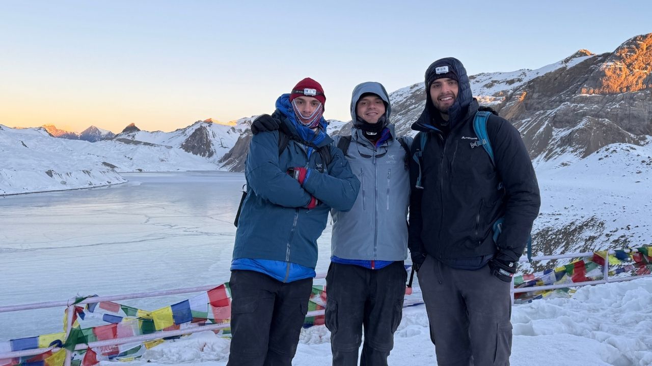
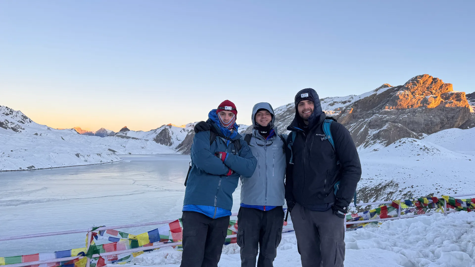
Finally overcoming the challenges, you will reach the Tilicho Lake. The high-altitude glacial lake sits in a natural basin below the massive Himalayan walls. You can get a clear view of the Annapurna and Tilicho Peak. The view of the turquoise water, which creates a striking contrast with the barren, rocky surroundings, will leave you awe-struck.

Additionally, there are no settlements or trees in the area, giving a strong sense of solitude. You will have some time to enjoy the views and the tranquil atmosphere. Then, you will begin your descent to base camp and then to Siri Kharka. 

Compared to ascending, descending is relatively easier. However, the rough and steep path can put strain on your knees. You will take a short break at the base camp and then continue descending to Siri Kharka. The descent helps with acclimatization as you will be sleeping at a lower altitude. You will retrieve your step back to Siri Kharka, where you will stay for the night.

Trekkers Near Tilicho Lake

Day 10 :

Trek from Siri Kharka (4,060m / 13,320 ft) to Ledar (4,200 m / 13,780 ft)

Trek Distance

11 km / 6.8 miles

Trek Duration

5-6 hours

Overnight Stay

Ledar

Highest Altitude

4,200 m / 13,780 ft (Ledar)

Meals

Breakfast, Lunch, and Dinner

Accommodation

Teahouse

You will reconnect with the main Annapurna Circuit trekking trail after you leave Siri Kharka. The route takes you toward the Marsyandi Valley. You will start with a gradual descent and join the route near Khangsar. From here, you will trek towards Yak Kharka. Compared to the previous day’s trek, it is less technical and demanding.

You will trek through open, barren, and high-altitude terrain. Due to the high altitude, you will need to maintain a slow, steady pace. As you move forward, the landscape becomes barren, but you will come across green pastures where you may catch sight of yaks and blue sheep grazing. 

You will continue to climb uphill along wide and exposed slopes. Along the way, you can see sweeping views of the towering snow-capped peaks and valleys. Likewise, you will follow the Thorong Khola. You will cross small wooden bridges and pass by scattered teahouses.

Throughout the trek, you can enjoy the peaceful mountain atmosphere. The trail takes you past Yak Kharka and gradually climbs. It is a steady uphill ascent, and finally, you will reach Ledar. The settlement, situated on a windswept plateau, is a small cluster of teahouses. You will rest here for the night. 

Day 11 :

Trek from Ledar (4,200 m / 13,780 ft) to Thorong High Camp ( 4,850 m / 15,912 ft)

Trek Distance

9 km / 5.6 miles

Trek Duration

4-5 hours

Overnight Stay

Thorong High Camp

Highest Altitude

4,850 m / 15,912 ft (Thorong High Camp)

Meals

Breakfast, Lunch, and Dinner

Accommodation

Teahouse

The trek today is short but a demanding uphill climb. You will leave Ledar after breakfast and start climbing gradually. The Annapurna Circuit Trek with Tilicho Lake and Poon Hill ascends through open, windswept terrain. It goes through the valley carved by the Thorong Khola.

You will see no trees or vegetation, and the landscape is fully alpine and barren. The path is relatively straightforward, but the high altitude makes the climb demanding. You will follow the path to reach Thorong Phedi. It is a popular resting point among trekkers. 

The real challenge begins from Thorong Phedi. From here, the winding trail begins to climb over loose rocks. Despite the short distance, the altitude and terrain make the climb more demanding. You may have to take frequent short treks and practice breathing control.

With the altitude gain, you can also get a clear view of the snow-capped peaks and deep valleys. Likewise, the area around you also gets colder and windier. Finally, you will reach the Thorong High Camp that sits on a ridge from where you can see the Thorong La Pass clearly. You will rest at the high camp for the night.

DHARMSALA

Day 12 :

Trek from Thorong High Camp ( 4,850 m / 15,912 ft) to Muktinath (3,760 m / 12,336 ft) via Thorong La Pass (5,416 m / 17,769 ft)

Trek Distance

16 km / 10 miles

Trek Duration

8-10 hours

Overnight Stay

Muktinath

Highest Altitude

5,416 m / 17,769 ft (Thorong La Pass)

Meals

Breakfast, Lunch, and Dinner

Accommodation

Teahouse

Today is one of the most challenging and adventurous days of the 16 Days Annapurna Circuit Trek with Tilicho Lake and Poon Hill. You will finally cross the high mountain pass of Thorong La. You will start early in the morning, around 3:30 to 4:30 AM, from Thorong High Camp. You will start with a slow, steady climb up the steep trail. The terrain is rocky and may be covered with snow.

Additionally, the lower oxygen level makes every step physically challenging. Mental focus is also equally crucial. The landscape becomes barren and frozen as you continue to ascend higher. After several hours of ascending, you will finally reach the summit of the Thorong La Pass. 

The colorful prayer flags and a signboard mark the top of the pass. Gorgeous views of the Annapurna and Dhaulagiri ranges will greet you. The mesmerizing views and a huge sense of achievement make the demanding effort worth it.

You will spend little time at the top of the pass to avoid altitude-related risks. The descent from the pass is equally demanding as ascending. It is long, steep, and physically more exhausting. The trail descends steeply through loose scree and rocky paths. As you climb downhill, the high-altitude terrain changes into wind-swept landscapes of Mustang. 

You will descend to Muktinath, the sacred site for Hindus and Buddhists. It will also be your overnight stop, a perfect stop to rest after the physically and mentally demanding crossing of Thorong La Pass.

couple in thorong la pass

Day 13 :

Drive from Muktinath (3,760 m / 12,336 ft) to Tatopani (1,190 m / 3,904 ft) via Jomsom (2,720 m / 8,924 ft)

Overnight Stay

Tatopani

road

Drive Distance

75 km / 46 miles

Drive Duration

6-7 hours

Highest Altitude

3,760 m / 12,336 ft (Muktinath)

Meals

Breakfast, Lunch, and Dinner

Accommodation

Teahouse

Today you will drive from Muktinath to Tatopani. After breakfast, you will get on a local bus and start a bumpy and thrilling ride. The winding road is dusty and rugged. You will drive past the dry and windswept landscapes of Mustang. You can get a clear view of the Nilgiri and Dhaulagiri ranges from the window of your bus. The bus will first take you to Jomsom. It is a key hub in the Mustang region and a famous stop along the Annapurna Circuit Trek. The town is well-known for its strong daily winds, which are common in the afternoon. 

From Jomsom, you will start to drive along the Kali Gandaki Valley, one of the world’s deepest gorges. The bus will continue along the bumpy, dusty road, passing through Thakali villages like Marpha. As the road descends and the landscape changes from barren and dry cliffs to green hills and forests.

Finally, you will reach Tatopani, a village famous for its natural hot springs. You will stay at the village for the night. In the evening, you can take your time dipping in the mineral-rich water of the hot spring and relaxing your tired muscles. It is the best way to help your body recover after long days of demanding trek.

Day 14 :

Trek from Tatopani (1,190 m / 3,904 ft) to Ghorepani (2,860 m / 9,383 ft)

Trek Distance

17 km / 10.5 miles

Trek Duration

7-8 hours

Overnight Stay

Ghorepani

Highest Altitude

2,860 m / 9,383 ft (Ghorepani)

Meals

Breakfast, Lunch, and Dinner

Accommodation

Teahouse

Day 14 marks a change in both altitude and terrain on the Annapurna Circuit with Tilicho Lake and Poon Hill Trek journey. You will leave the low river valley and begin to ascend into the mid-hills of the Annapurna region. After breakfast, you will leave Tatopani by crossing a suspension bridge and entering lush forests. The trekking trail gradually ascends as it passes through traditional Gurung villages and terraced farmlands. As you continue, the route becomes more demanding. 

You will start to ascend towards Ulleri, where you will climb up a long series of around 3,000 steep stone staircases. It is considered one of the most demanding stair climbs in the Annapurna region. You will need good stamina, endurance, and steady pacing to overcome these staircases.

From Ulleri, the trekking trail enters dense forests of rhododendron and oaks. The air becomes cooler and crisper. You will trek on a mix of forest trail and stone-paved paths. The forest becomes denser as you start to get closer to Ghorepani. It is a beautiful Magar village that sits on a ridge and is famous as the “Rhododendron Capital.” You will stay here for the night. 

Day 15 :

Early hike to Poon Hill Viewpoint (3,210 m / 10,531 ft), trek to Tikhedhunga (1,540 m / 5,053 ft), & drive to Pokhara (820 m / 2,690 ft)

Trek Distance

12 km / 7.5 miles

Trek Duration

5-6 hours

Overnight Stay

Pokhara

road

Drive Distance

50 km / 31 miles

Drive Duration

2-3 hours

Highest Altitude

3,210 m / 10,531 ft (Poon Hill)

Meals

Breakfast, Lunch, and Dinner

Accommodation

Teahouse

You will wake up early in the morning, before dawn, as you will take a hike to the Poon Hill Viewpoint for sunrise. It is about an hour’s hike from Ghorepani. You will ascend the stone staircases with the help of headlamps. The trail passes through a lush rhododendron forest. It is a steady but continuous uphill climb to the viewpoint.

From the open patches, you can get a glimpse of the surrounding peaks. Finally, you will reach the famous Poon Hill Viewpoint that offers panoramic Himalayan views. Witness the sunrise over the Annapurna and Dhaulagiri ranges, which glow in golden light. 

You will descend to Ghorepani after enjoying the iconic sunrise and continue descending to Tikhedhunga. The downhill trail takes you through forest ridges, steep stone steps, and hillside paths. The landscape changes into lush forests of rhododendron and oaks. Similarly, you will pass by Magar villages and terrace farmland.

From Tikhedhunga, you will hop on a jeep and drive toward Pokhara. The winding hill road takes you through valleys, hills, and small towns. Upon reaching Pokhara, the landscape shifts to a subtropical lake city. You will stay overnight in Pokhara, so you can explore Lakeside or take a boat on Phewa Lake in the evening.

Day 16 :

Drive from Pokhara (820 m / 2,690 ft) to Kathmandu (1,324 m / 4,343 ft)

Overnight Stay

Kathmandu

road

Drive Distance

200 km/ 124 miles

Drive Duration

6-8 hours

Highest Altitude

1,324 m / 4,343 ft (Kathmandu)

Meals

Breakfast, Lunch, and Dinner

Today is the final day of the 16 Days Annapurna Circuit Trek with Tilicho Lake and Poon Hill. You will take a tourist bus from Pokhara early in the morning and drive to Kathmandu. It is a scenic overland drive that takes you through lush green hills, settlements, and terraced farmlands. The road follows the Trishuli River, passing through deep gorges and along sandy riverbanks. It is a visually rich experience. 

Halfway through the drive, you will reach Mugling. It is a key highway junction from where the road becomes busier. The road from here begins to climb towards Kathmandu Valley. The landscape changes from river valleys to densely populated hillsides and urban areas. Entering the valley, the road becomes busier and more congested. You will arrive in Kathmandu in the afternoon, and your trek journey comes to an end. Thank you for choosing Outbound Treks!

Annapurna Circuit Trek with Tilicho Lake and Poon Hill Includes

  • Private vehicle pick-up and drop-off service between Kathmandu Airport and your hotel.
  • Overland transportation, as mentioned in the itinerary
  • All teahouse accommodation during the trek (15 nights)
  • 1 Night hotel stay in Pokhara
  • Standard meal (16 breakfasts, 16 lunches, and 16 dinners)
  • Seasonal fruits after dinner
  • Trek Permits (Annapurna Conservation Area Permit)
  • Experienced English-speaking, government-licensed trekking guide
  • Porter (1 porter for two trekkers), max weight limit is 18 kg (9 kg per trekker)
  • Full coverage of wages, meals, lodging, transport, insurance, and gear for guides and porters
  • Trek map
  • Oxygen saturation check every day
  • Water purification tablets
  • Trek completion certification
  • Trekking briefing before departure
  • First aid medical kit carried by the guide
  • Sleeping bags, down jackets, and a duffel bag (one for every two trekkers)
  • Farewell dinner at the end of the trek
  • All government, local taxes, and official expenses

Annapurna Circuit Trek with Tilicho Lake and Poon Hill Excludes

  • Hotel accommodation and meals in Kathmandu
  • International flight ticket
  • Nepal tourist visa fees
  • Travel insurance (Mandatory and must include high-altitude emergency and helicopter evacuation coverage)
  • Tips for guides, porters, and staff  (It is appreciated)
  • Personal expenses of all forms (alcoholic drinks, bottled water, hot shower, charging devices, snacks, desserts, laundry, Wi-Fi, phone calls, etc.)

Make Your Journey Private

Experience Nepal exactly the way you imagined it. Our private trips are crafted with complete flexibility with your dates, your pace, your preferences. Whether you want a slow cultural immersion, a scenic road journey.

Additional Information

Standard Annapurna Circuit vs Extended Route with Tilicho & Poon Hill

The difference between the standard Annapurna Circuit and the extended route with Tilicho & Poon Hill is not just about duration. There is a difference in the overall experience. Here are the major differences between the two treks:

Features Standard Annapurna Circuit Trek Annapurna Circuit Trek with Tilicho & Poon Hill
Route Classic circuit route around the Annapurna massif via Manang and Thorong La Pass Classic circuit route around the Annapurna massif with a detour to Tilicho Lake, and ends at Poon Hill
Duration 10-14 days 14-18 days
Difficulty Moderate to challenging  Challenging
Maximum altitude Thorong La Pass (5,416 m) Thorong La Pass (5,416 m)
Landscape Lush forests, alpine meadows, and high-altitude desert landscapes.  Lush forests, alpine meadows, glacial basins, and high-altitude desert landscapes
Crowd level Busy Busy but quieter in areas like Tilicho
Acclimatization Standard acclimatization in Manang Standard acclimatization in Manang
Highlights Thorong La Pass, Kali Gandaki Valley, traditional villages, and mountain views of the Annapurna and Dhaulagiri ranges.  Tilicho Lake, Thorong La Pass, Kali Gandaki Valley, traditional villages, sunrise from Poon Hill, and mountain views of the Annapurna and Dhaulagiri ranges.
Best for Classic adventure seekers, first-timers, and trekkers with shorter trekking times. Experienced trekkers and adventurers looking for a more enriching experience and a flexible schedule.

In summary:

The standard Annapurna Circuit Trek offers the classic Himalayan trekking experience with diverse landscapes, crossing of Thorong La Pass, and cultural villages. Trekkers can also see the spectacular views of Mount Annapurna II, Dhaulagiri, Pisang Peak, and Nilgiri Himal. 

On the other hand, the Annapurna Circuit Trek with Tilicho and Poon Hill offers a more immersive and complete Annapurna trekking experience. In addition to the classic trail, the journey adds a high-altitude adventure to Tilicho Lake and one of the best sunrise views from the iconic Poon Hill Viewpoint. The trek offers an excellent view of the Annapurna and Dhaulagiri ranges.

Is Tilicho Lake and Poon Hill Worth Adding to the Annapurna Circuit Itinerary

Absolutely yes, adding the Tilicho Lake and Poon Hill to the Annapurna Circuit Trek itinerary is worth it. It adds the classic adventure into a more immersive, multi-layered Himalayan journey. By combining them, you will get three unique experiences into one single trek. You will get to explore the remote high-altitude Tilicho Lake, cross the Thorong La Pass, and enjoy the classic Himalayan panorama from Poon Hill Viewpoint. 

The trek combines different iconic trails of the Annapurna region. You will trek on the classic Annapurna Circuit and take a detour to one of the world’s highest lakes, Tilicho. Then, you will cross the high mountain pass of Thorong La and descend to Muktinath before joining the famous Ghorepani Poon Hill trail. The diverse landscapes, spectacular mountain views, and rich cultural immersion make this trek one of the most complete and rewarding trekking experiences. Hence, these two side tours are worth adding to the Annapurna Circuit Trek. 

However, there are pros and cons of adding Tilicho Lake and Poon Hill to the Annapurna Circuit Trek. You must understand the pros and cons before deciding whether to add the detours. 

Pros (Why is it worth it?)

Here are the reasons why the Annapurna Circuit Trek with Tilicho Lake and Poon Hill is worth it:

  • Experience the hidden side of the Annapurna region and step away from the main trail into the glacial landscape of Tilicho Lake. The route to the lake feels more isolated and less commercialized. It offers a sense of discovery to the adventurous trek. 
  • You will trek through more diverse landscapes by adding Tilicho Lake and Poon Hill. The trekking trail covers forest paths, alpine meadows, green pastures, glaciers, and high-altitude desert. It gives a sense of the “full version” of the Annapurna Circuit.
  • Experience one of the best panoramic sunrise views from the Poon Hill viewpoints. You can witness the wide view of the Annapurna and Dhaulagiri ranges. The vantage point is a short hike from the famous Ghorepani village, also known as the “Rhododendron Capital” of Nepal. In springtime, the entire forest blooms into different shades of red, pink, and white.
  • The combined trekking trail takes you past several viewpoints. These points are ideal for witnessing spectacular views and offer better photography opportunities. It is perfect for photographers and nature enthusiasts who want to capture and experience the raw beauty of the Himalayas. 
  • Combining the Annapurna Circuit with Tilicho and Poon Hill also offers higher personal satisfaction. Reaching one of the world’s highest lakes and then crossing the high Thorong La Pass in one single trek offers a greater sense of achievement. It is more rewarding and boosts your confidence.

Cons (What most people don’t tell you about?)

Here are some things that you need to understand about combining the side trips to the main Annapurna Circuit Trek: 

  • The trail to Tilicho is thrilling but also physically more demanding. You have to trek through landslide-prone areas and terrain with loose scree. Additionally, a sudden change in the weather can add to the difficulty. The side trip to the lake is not just a scenic addition, but also one of the most challenging parts of the combined trek. 
  • Combining the treks is not only physically more demanding but also extends the duration and exposure to the high altitude. It requires more time planning and commitment. The longer exposure to an altitude above 4,000 m also increases the risk of altitude sickness. 
  • Compared to the Annapurna Circuit main trail, the trail to Tilicho Lake only has basic infrastructure. There are fewer teahouses and facilities, and food options are limited. So, trekkers need to be prepared for rustic facilities.
  • The longer the trek, the higher the overall expenses. You will have to pay additional costs for accommodation, meals, guides, porters, and transportation. It may be costlier for backpackers and trekkers looking for a budget-friendly adventure. 

Which season favors all the Annapurna Circuit, Tilicho, and Poon Hill routes?

The spring (March to May) and autumn (September to November) seasons are ideal for all Annapurna Circuit, Tilicho, and Poon Hill routes. The trek routes take you through various climate zones, and the season highly influences them. It affects weather conditions, trail accessibility, and overall trekking experience. Hence, it is crucial to choose the right season that favors all the trekking routes. 

Annapurna Circuit Trekker Group Photo

Here is a brief on the seasons so that you can understand them better:

Spring (March to May): Perfectly Balanced Season

The spring season offers the best overall trekking conditions for the Annapurna Circuit with Tilicho Lake and Poon Hill. There may be light snowfall in higher-altitude areas at the start of the season. As the season progresses, temperatures start to warm, and the weather becomes more stable. The flora and fauna also become more active. The rhododendron forests in the lower Annapurna region bloom in full. Especially the trail to Ghorepani and Poon Hill is colored in different shades of red, pink, and white. 

Additionally, the stable weather makes spring the perfect time to take the Tilicho Lake side trip. The visibility is brilliant, so you get the best views of the vibrant landscapes with blooming flowers and snow-capped mountains. You can enjoy the rare visual contrast between the colorful lower sections and snowy vistas and clear blue skies. The average temperature in spring at different altitudes along the route is as follows: 

  • Lower regions: 10°C to 20°C
  • Poon Hill: 5°C to 15°C
  • Manang/Tilicho: -5°C to 10°C
  • Thorong La: -10°C to 5°C

Autumn (September to November): Season of Clarity and Comfort

The peak season for the Annapurna Circuit with Tilicho Lake and Poon Hill Trek is autumn. It offers the most stable weather with extremely sharp clarity. The season follows the monsoon, so the rain from the previous season cleanses the air of dust and pollution. As a result, the skies are clear, and visibility is sharper. You can enjoy the best views of the Annapurna and Dhaulagiri ranges from high points such as Thorong La Pass, Tilicho Lake, and Poon Hill viewpoint. 

In addition to the clear skies, the days are less windy, and the temperature is moderate. Therefore, you can get the best reflections at Tilicho Lake. Autumn is the best time to capture the crystal-clear photographs of the classic Himalayan views. In the lower region, the forests turn yellow, which adds to the rich visual experience. Moreover, the season coincides with the biggest Nepalese festivals, Dashain and Tihar. It offers a more culturally rich trekking experience. The average autumn temperature along the Annapurna Circuit with Tilicho Lake and Poon Hill Trek route is as follows:

  • Lower regions: 10°C to 18°C
  • Poon Hill: 5°C to 12°C 
  • Manang/Tilicho: -8°C to 8°C
  • Thorong La: -15°C to 5°C

Which day feels the most physically challenging on the Annapurna Circuit, Tilicho Lake, and Poon Hill Trek?

The side trip to the Tilicho Lake is the most physically challenging on the Annapurna Circuit, Tilicho Lake, and Poon Hill Trek route, followed by the Thorong La Pass crossing. It might come as a surprise, as many trekkers would think that crossing the high mountain pass will be the toughest. Contrary to the belief, the side hike to one of the world’s highest glacial lakes is actually more demanding. Here is the breakdown on both days:

Tilicho Lake hike, the hardest day

Day 9 of our Annapurna Circuit with Tilicho Lake and Poon Hill Trek itinerary is the hardest. The entire round trip from Tilicho Base Camp to Tilicho Lake and back to Siri Kharka takes 7 to 8 hours. It is one of the longest trek days on our itinerary. Hence, you will start early in the morning. The long duration is not the only reason the hiking day is the hardest. You will also be exposed to an altitude above 4,000 m for a long period of time. It increases the risk of altitude sickness, but there are minimal resting villages and spots along the way.

The trail to the Tilicho Lake is steep, narrow, and exposed. Along the way, you must also cross landslide-prone areas. The combination of exposed trail, high altitude, and narrow paths makes the trek feel harder than normal days. With no flat sections or rest stops, you have to hike continuously for hours. Likewise, you need to constantly focus on your footing, as the terrain is mostly loose rocks and scree. It is not only physically demanding but also mentally draining.  

The Tilicho Lake is at an altitude of 4,920 m, which is nearly 5,000 m. Thus, the oxygen level is low, and one may experience altitude-related effects such as a slower walking pace, increased breathing rate, extreme fatigue, headache, or dizziness. The weather also changes rapidly, and cold winds are common near the lake. Sudden clouds can reduce the visibility, so most trekkers ascend to the lake early in the morning. 

The unstable trail, continuous climb, rapid altitude gain without much acclimatization make the side hike to Tilicho Lake more challenging than any other days in the trek. But the reward after the challenge is also deeply satisfying and unforgettable. In the tranquil atmosphere, you will witness the spectacular turquoise alpine lakes and the surrounding Himalayan peaks. 

Thorong La Crossing, the second hardest day

After the side hike to Tilicho Lake, crossing the Thorong La Pass is the second hardest day of the Annapurna Circuit, with Tilicho Lake and Poon Hill Trek. On our 16-day itinerary, you will cross the pass on day 12. The main difficulty in crossing the pass is the high altitude. Compared to the climb to Tilicho Lake, the route to Thorong La Pass is less technical and less exposed. The ascent is also gradual, which gives your body better time to adapt to the growing elevation. But the altitude is higher and more intense. 

You will start early in the morning, around 3:30 to 4:00 AM. It is cold and dark, but you have to start early to avoid the high wind that is common after late morning. The uphill climb from Thorong Phedi or High Camp takes 4 to 6 hours. It is relatively gradual but continuous. As you gain elevation, the thinner air makes breathing more difficult. The climb also becomes slow and exhausting. As you will ascend to 5,416 m elevation, there is a higher risk of altitude sickness.

Due to the high altitude, you will spend only a limited time at the top of the Thorong La Pass. The top is also exposed to strong winds and cold temperatures. After the steep climb, you have to make a long descent towards Muktinath. It can put heavy strain on your knees and legs. The descent takes 3 to 5 hours. Crossing the Thorong La Pass requires mental endurance along with physical fitness. As it is the highest point of the Annapurna Circuit Trek with Tilicho Lake and Poon Hill, you can witness one of the best views of the Annapurna massif, Dhaulagiri range, and other surrounding peaks. 

Common Questions on Annapurna Circuit Trek with Tilicho Lake and Poon Hill

Travel Tips, Stories, & Guides

Travel guides, trekking stories, and blogs from Outbound Treks.

Begin Your Himalayan Story

When it comes to exploring Nepal, experience matters. We will expertly guide you for a safe, comfortable, and authentic adventure. With years of local expertise, we take care of every detail, so you can focus on creating unforgettable memories. Contact us today to plan your dream adventure with Outbound Treks.