


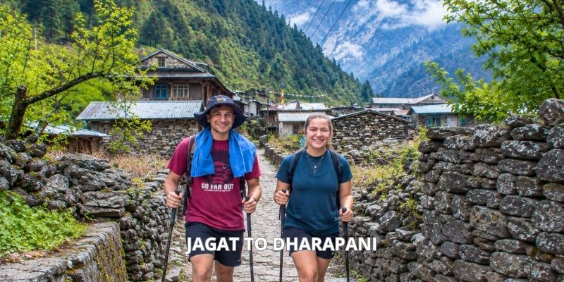
Jagat to Dharapani Trek Distance Quick Facts:
- Total Distance Covered: 15 km/9.3 miles
- Trek Duration: 5-6 hours
- Starting Point: Jagat
- Starting Elevation: 1,300 m / 4,265 ft
- Ending Point: Dharapani
- Ending Elevation: 1,860 m / 6,102 ft
- Trail: Marsyangdi → Dharapani
- Difficulty: Moderate with steep ascents, descents, and uneven mountain trails
The distance from Jagat to Dharapani is 15 km (9.3 miles), and it took me about 6 hours to complete. When I started writing this blog, I didn’t remember the distance, but I did remember how the landscape changed along the way during the entire Annapurna Circuit Trek. I started my trek from Jagat, following the Budhi Gandaki Valley through small mountain villages, waterfalls, suspension bridges, and sections of ascent and descent. My journey continued through places like Chyamche, Tal, and Karte before reaching Dharapani.

Jagat to Dharapani Difficulty
When I began my trek from Jagat to Dharapani, I found the 15 km pathway, taking 6 hrs, moderately difficult, with some sections quite challenging. At first, I walked through a lower-altitude landscape, but the challenge began soon after leaving Jagat when I climbed many steep stone steps out of Jagat.
As the trek continued, I crossed suspension bridges, climbed steep uphill sections, and walked along narrow, rocky trails beside the Budhi Gandaki River. Some sections were mentally tiring, especially after hours of continuous walking.
Along the Jagat to Dharapani section, I noticed the route’s difficulty came from the landscape rather than the distance. I had to maintain a steady pace and take enough time to regain energy. The gradual increase in elevation added to the overall effort. The distance was manageable; however, the constant ups and downs, uneven stone paths, and steep sections made the journey physically and mentally challenging.
Jagat to Dharapani Route Breakdown
Jagat to Dharapani route at a glance:
| Route Section | Distance | Time Taken | What I Experienced |
| Jagat → Chyamche | 2.5 km | 1 hour | Rocky sections, forests, and waterfalls |
| Chyamche → Tal | 6 km | 2.5-3 hours | Steep climbs, river views, suspension bridge, and Marsyangdi Valley |
| Tal → Dharapani | 6.5 km | 3 hours | Forested sections, mountain villages, and change in scenery |
Jagat to Chyamche
The day began in Jagat after a hearty breakfast at the teahouses where I stayed. Then I packed my bag and began the day’s walk, following the river. The initial phase of the trek was gentle, with the river’s sound accompanying me as I made my way through green hills.
After some time of walking, I came across a short but steep section of stairs. The steps were uneven in places, and I had to take my time, but the climb didn’t last for too long. Once I was back on the main route, the walk became enjoyable with views of forests, rocky paths, and the river.
As I continued towards Chyamche, I started noticing more waterfalls along the opposite side of the valley. I stopped several times to take photos because the scenery was too stunning to walk by. After about an hour of walking from Jagat, I reached Chyamche.
Chyamche to Tal
From Chyamche, I continued along the route with the Marsyangdi River following me. I crossed the river via the first suspension bridge of the day. This section felt more adventurous, with a mixture of stone steps, rocky paths, and short uphill climbs. The pathway passed through beautiful forest sections, and with every step, I could see the river far below. I also came across several waterfalls and small streams along the way, which gave me reasons to slow down and enjoy the scenery.
The walk wasn’t extremely long, but the repeated ups and downs made me quite tired. I took breaks from time to time, especially on the steeper sections. At a small teahouse, I rested briefly before continuing to Tal.
Getting to Tal felt like stepping into a different location where the valley opened up. The sound of the river, the surrounding green hills, and traditional mountain houses made the Tal village especially beautiful. I had my lunch in Tal village at midday.
Tal to Dharapani
After lunch at Tal, I continued walking towards Dharapani via Marsyangdi Valley. This was the longest section of my Jagat to Dharapani route, but the good part was that my body was slowly adjusting to the changing landscape. The route took me through forests and several small mountain villages. There were several ascents and descents, but the changing scenery kept the walk interesting.
I crossed another suspension bridge on this section. I also passed waterfalls and continued walking alongside the river, with mountain peaks in the distance. One thing I really enjoyed about this section was how quickly the scenery changed. One moment I was walking through dense forest, and later I would see an open section with views of mountain peaks and ancient villages.
The final walk to Dharapani felt especially stunning. After walking from Jagat through Chyamche and Tal, reaching the day’s destination felt like an achievement. I could finally stop, put my bag down, and relax in my bed.
Highlights of Jagat to Dharapani Route
Waterfalls
The waterfalls were a major highlight of the Jagat to Dharapani route. They weren’t just occasional views in the distance; they were close to the trail, and the large waterfall near Chyamche was one of the moments that made me stop and take out my camera. I could see and hear the water from the path, which kept me motivated to keep walking even when my legs felt tired.
Marsyangdi River
One of the first things I noticed after leaving Jagat was how closely the trek followed the Marsyangdi River. For most of the route, I could hear the rushing roar of the river beside me and below me, especially on my way to Chyamche and Tal. The sound and view of the Marsyangdi River added something special to the walk, making it a memorable highlight of the Jagat to Dharapani section.
Suspension Bridges
The suspension bridges were another part of the journey that I genuinely enjoyed. They made crossing the Marsyangdi River an enjoyable part of the trek. Standing in the middle of a bridge, I could look down at the river while seeing rising hills on both sides. Some crossings were quick, while others made me stop and take my time to enjoy the view.
Small Villages
Another highlight of the Jagat to Dharapani route was the small mountain villages throughout the section. I saw traditional houses, local paths, and everyday life along the route. For me, walking through those small settlements added authenticity to the trek because I experienced the route as a living part of the mountain communities.
Forests, Rocks, and Stone Steps
I liked how different the actual walking route was throughout the Jagat to Dharapani route. One moment I was walking through a forested section, and after some time, I was climbing over rocky sections and following stone steps. The changing terrain made the trek feel varied rather than like one continuous trail.
Jagat to Dharapani Elevation Gain & Altitude Sickness
Jagat to Dharapani elevation gain at a glance:
| Facts | Details |
| Starting elevation | 1,300 m / 4,265 ft (Jagat) |
| Ending elevation | 1,860 m / 6,102 ft (Dharapani) |
| Elevation Gain | +560 m (1,837 ft) |
| The elevation progression | Jagat (1,300 m) → Chyamche (1,430 m) → Tal (1,700 m) → Dharapani (1,860 m) |
The interesting part of Jagat to Dharapani elevation gain is that this is not a straightforward 560-meter uphill climb. The trail repeatedly rises and drops as it follows the Marsyangdi River, passes waterfalls and suspension bridges, and moves through Tal before the final approach to Dharapani.
Did I Experience Altitude Sickness From Jagat to Dharapani?
I did not experience serious altitude sickness on this section, but I became more conscious of my body as the elevation increased. At these altitudes, altitude sickness is generally less of a concern than it becomes later on the Annapurna Circuit, but I still avoided rushing.
I kept my walking pace comfortable, drank water regularly, and took short breaks whenever I felt tired. I also paid attention to symptoms such as headache, unusual dizziness, nausea, or excessive fatigue rather than assuming every feeling was simply caused by a long walking day.
For me, the most important lesson from Jagat to Dharapani was that altitude gain is not only about the final elevation. The repeated ascents and descents, changing terrain, and several hours of walking all contribute to how tiring the day feels.
By the time I reached Dharapani, I felt that my body was gradually adjusting to the Annapurna landscape. This is an important section in Annapurna Circuit Trek route. I treated this section as an opportunity to settle into a steady rhythm rather than trying to cover the trail quickly.
Jagat to Dharapani Transportation Options
One important thing I learned while planning the Jagat to Dharapani section is that I don’t necessarily have to trek all the way from Jagat to Dharapani. In fact, a 4WD jeep can now take you directly from Jagat to Dharapani via the same walking route through Chyamche and Tal.
If I don’t want to walk this section, I can take a 4WD jeep directly. The drive isn’t a smooth highway journey. It’s a bumpy, rocky, and narrow mountain road along the Marsyangdi River. So, only a jeep can take you from Jagat to Dharapani, not a normal bus or car, because they cannot handle the rough, rocky off-road track.
Transportation Options:
| Transportation Option | Cost |
| Private 4WD jeep | NPR 10,000 to NPR 15,000 |
| Shared 4WD jeep | NPR 1,000 to NPR 1,500 per person |
Best Time For Jagat to Dharapani
During my Jagat to Dharapani walk, I found that the season made a noticeable difference to the trail experience. This section follows the Marsyangdi Valley, passing through forests, waterfalls, suspension bridges, stone paths, and the beautiful village of Tal before reaching Dharapani. As someone who has been on this trail in each of the four seasons, I can say that spring and autumn offered the most enjoyable conditions.
Spring (March to May)
I particularly enjoyed spring because the lower Marsyangdi Valley looked fresh and green. The forests around Jagat were colorful, and the waterfalls along the trail added to the scenery. The weather was also comfortable for the steady climbs and descents toward Tal and Dharapani. April and May were especially pleasant for walking without the intense heat of summer.
Autumn (September to November)
Autumn gave me some of the clearest conditions on this section. After the monsoon, the valley looked refreshed, while clearer skies made the surrounding cliffs and hills more impressive. October and November are especially comfortable for the walk, although mornings can start feeling cooler as the trail approaches Dharapani.
Winter (December to February)
I found winter much quieter, which gave the trail a peaceful atmosphere. The lower section around Jagat was still manageable, but mornings became noticeably colder, particularly around Dharapani. Clear winter days can still offer beautiful views along the valley.
Monsoon (June to August)
The monsoon transformed the valley into a lush landscape, and the waterfalls became much more powerful. However, I found the wet conditions less convenient because sections of the trail can become muddy and slippery, while landslides and road disruptions may affect the journey.
What Trekkers Ask About the Jagat to Dharapani Route
Are permits required for the Jagat to Dharapani route?
How hard is the walk from Jagat to Dharapani?
How far is it from Jagat to Dharapani?
Is there a way to avoid walking on the road?
When is the best time to go to Dharapani via Jagat?


