
travel expert

Speak with Hari Gurung +9779768604351

Three High Passes Trek

17 Days Three High Passes Trek Facts

Starting/Ending Point

Kathmandu/ Kathmandu

Duration

17 Days

Max. Altitude

5,545 m / 18,192 ft (Kalapathhar)

Accommodation

Teahouse/ Lodges

Activity Per Day

5-7 hours

Best Season

September, October, November, December, January, February, March, April, May

Group Size

1 - 15

Meals Included

Breakfast, Lunch, Dinner

Difficulty

Challenging

Activity

Trekking in Nepal

Nature Of Trek

Teahouse Trekking

Transportation

Domestic flight

What to Expect on Three High Passes Trek

The Everest Three High Passes Trek is designed for experienced trekkers who want to explore the full Everest region. Over 17 days, you will cross three high passes: Renjo La (5,360 m), Cho La (5,420 m), and Kongma La (5,535 m). You will travel through every major landmark, place, valley, village, monastery, etc in the Everest region. Although this trek is not suitable for beginners, trekkers with decent physical fitness, an understanding of acclimatization, and the ability to follow the guide can successfully cross these high passes.

Your adventure starts with a short flight from Kathmandu or Manthali to Lukla. During peak seasons, the local flight to Lukla is diverted to Manthali because several international flights are operating at Kathmandu Airport. Then you will gradually ascend through Phakding and make an important stop in the Sherpa capital, “Namche Bazaar”, for acclimatization. From Namche, you will head to Thame and Lungden before reaching the beautiful Gokyo Lake via the Renjo La Pass. You will have a rest day to summit Gokyo Ri early in the morning, where you can enjoy stunning views of the Ngozumpa Glacier and the surrounding Khumbu region.

Next, you will cross the challenging Cho La Pass into the Khumbu Valley. You will reach Everest Base Camp and, the next day, Kala Patthar, where the sunrise view is unforgettable. Following that, you will cross Kongma La Pass to complete a circular route that takes you through diverse landscapes, including lush forests, quiet villages, glacial moraines, and alpine lakes. After crossing Kongma La Pass, you will descend to Chhukung and then move on to Tangboche. From Tangboche, you will travel south, then return to Namche Bazaar and Lukla. Finally, you will fly back to Kathmandu from Lukla.

This carefully planned itinerary provides enough rest days for acclimatization. You will enjoy unique views of famous sights such as the Ngozumpa Glacier and high-altitude lakes, all while surrounded by the beauty of Everest, Lhotse, Makalu, and Cho Oyu. The Three High Pass trek is among the most challenging high-altitude treks. Without proper planning, it can become either a dream experience or a stressful memory. This guide simplifies the trekking process so you can plan confidently and focus on the journey ahead.


Why Trekkers Choose Three High Passes Trek

  • Cross the three iconic high passes: Kongma La (5,535m), Cho La (5,420m), and Renjo La (5,360m).
  • Reach Everest Base Camp for an up-close experience at the foot of the world’s highest mountain.
  • Enjoy majestic sunrise views of Everest and surrounding peaks from Kala Patthar (5,643m).
  • Explore the stunning Gokyo Lakes and the massive Ngozumpa Glacier.
  • Summit Gokyo Ri for astonishing vistas of Everest, Cho Oyu, and Makalu.
  • Visit the ancient Tengboche Monastery amid dramatic Himalayan scenery.
  • Traverse diverse landscapes from lush valleys to rugged glacial moraines in Sagarmatha National Park.
  • Immerse in authentic Sherpa culture through vibrant villages like Namche Bazaar.

Daily Altitude Progress During The 17 Days of the Three High Passes Trek

Day 01: Flight from Kathmandu (1,324 m / 4,343 ft) / Manthali (474 m / 1,555 ft) to Lukla (2,860 m / 9,383 ft), then trek to Phakding (2,610 m / 8,563 ft).

  • Altitude Gain: 1,536 m / 5,039 ft (from Kathmandu) / 2,386 m / 7,828 ft (from Manthali)

  • Altitude Loss: 250 m / 820 ft (from Lukla to Phakding)

Day 02: Trek from Phakding (2,610 m / 8,563 ft) to Namche Bazaar (3,440 m / 11,286 ft).

  • Altitude Gain: 830 m / 2,723 ft

  • Altitude Loss: 0 m / 0 ft

Day 03: Acclimatization at Namche Bazaar (3,440 m / 11,286 ft), side hike to Everest View Hotel (3,880 m / 12,730 ft), and return to Namche.

  • Altitude Gain: 440 m / 1,444 ft

  • Altitude Loss: 440 m / 1,444 ft

Day 04: Trek from Namche (3,440 m / 11,286 ft) to Thame (3,800 m / 12,467 ft).

  • Altitude Gain: 360 m / 1,181 ft

  • Altitude Loss: 0 m / 0 ft

Day 05: Trek from Thame (3,800 m / 12,467 ft) to Lungden (4,380 m / 14,370 ft).

  • Altitude Gain: 580 m / 1,903 ft

  • Altitude Loss: 0 m / 0 ft

Day 06: Trek from Lungden (4,380 m / 14,370 ft) to Gokyo (4,790 m / 15,715 ft) via Renjo La Pass (5,360 m / 17,585 ft).

  • Altitude Gain: 980 m / 3,215 ft

  • Altitude Loss: 570 m / 1,870 ft

Day 07: Acclimatization day in Gokyo (4,790 m / 15,715 ft), optional hike to Gokyo Ri (5,357 m / 17,575 ft), and return to Gokyo.

  • Altitude Gain: 567 m / 1,860 ft

  • Altitude Loss: 567 m / 1,860 ft

Day 08: Trek from Gokyo (4,790 m / 15,715 ft) to Thangnak (4,750 m / 15,584 ft).

  • Altitude Gain: 0 m / 0 ft

  • Altitude Loss: 40 m / 131 ft

Day 09: Trek from Thangnak (4,750 m / 15,584 ft) to Dzongla (4,830 m / 15,846 ft) via Cho La Pass (5,420 m / 17,782 ft).

  • Altitude Gain: 670 m / 2,198 ft

  • Altitude Loss: 590 m / 1,936 ft

Day 10: Trek from Dzongla (4,830 m / 15,846 ft) to Lobuche (4,940 m / 16,207 ft).

  • Altitude Gain: 110 m / 361 ft

  • Altitude Loss: 0 m / 0 ft

Day 11: Trek from Lobuche (4,940 m / 16,207 ft) to Gorakshep (5,164 m / 16,942 ft), hike to Everest Base Camp (5,364 m / 17,598 ft), and return to Gorakshep.

  • Altitude Gain: 424 m / 1,391 ft (to Gorakshep) + 200 m / 656 ft (to Everest Base Camp)

  • Altitude Loss: 200 m / 656 ft (from Everest Base Camp to Gorakshep)

Day 12: Early morning hike to Kala Patthar (5,545 m / 18,192 ft) from Gorakshep (5,164 m / 16,942 ft), then trek to Lobuche (4,940 m / 16,207 ft).

  • Altitude Gain: 381 m / 1,250 ft

  • Altitude Loss: 605 m / 1,985 ft (from Kala Patthar to Lobuche)

Day 13: Trek from Lobuche (4,940 m / 16,207 ft) to Chhukung (4,730 m / 15,518 ft) via Kongma La Pass (5,535 m / 18,160 ft).

  • Altitude Gain: 595 m / 1,952 ft

  • Altitude Loss: 805 m / 2,641 ft

Day 14: Trek from Chhukung (4,730 m / 15,518 ft) to Pangboche (3,985 m / 13,074 ft).

  • Altitude Gain: 0 m / 0 ft

  • Altitude Loss: 745 m / 2,444 ft

Day 15: Trek from Pangboche (3,985 m / 13,074 ft) to Namche Bazaar (3,440 m / 11,286 ft).

  • Altitude Gain: 0 m / 0 ft

  • Altitude Loss: 545 m / 1,788 ft

Day 16: Trek from Namche (3,440 m / 11,286 ft) to Lukla (2,860 m / 9,383 ft).

  • Altitude Gain: 0 m / 0 ft

  • Altitude Loss: 580 m / 1,903 ft

Day 17: Fly from Lukla (2,860 m / 9,383 ft) to Kathmandu (1,324 m / 4,343 ft) / Manthali (474 m / 1,555 ft).

  • Altitude Gain: 0 m / 0 ft

  • Altitude Loss: 1,536 m / 5,039 ft (to Kathmandu) / 2,386 m / 7,828 ft (to Manthali)

Itinerary for 17 Days Three High Passes Trek

Day 01 :

Flight from Kathmandu (1,324 m / 4,343 ft) / Manthali (474 m / 1,555 ft) to Lukla (2,860 m / 9,383 ft) & trek to Phakding (2,610 m / 8,563 ft)

Trek Distance

8 km / 4.97 miles

Trek Duration

4 hours

Overnight Stay

Phakding

Flight Hours

40 minutes from Kathmandu/ 20 minutes from Manthali

Highest Altitude

2,860 m / 9,383 ft (Lukla)

Meals

Breakfast, Lunch, and Dinner

Accommodation

Teahouse

The first day of the Everest Three High Pass Trek begins with an amazing early-morning flight from Kathmandu or Manthali (during seasonal restrictions) to Lukla. It is the home of Tenzing-Hillary Airport, one of the most dramatic airstrips in the world. It is perched on a short, sloping runway, with mountains looming at both ends.

Upon landing at Lukla, you’ll meet your guide and porter, greet them, and enjoy a quick, delicious breakfast. You will then head to Phakding, where the trek is mostly downhill for about 8 km and takes 3-4 hours. The path winds through charming Sherpa villages like Cheplung and Ghat, passing colorful mani stones inscribed with Buddhist prayers, spinning prayer wheels, and fluttering prayer flags that signal entry into the sacred Khumbu region.

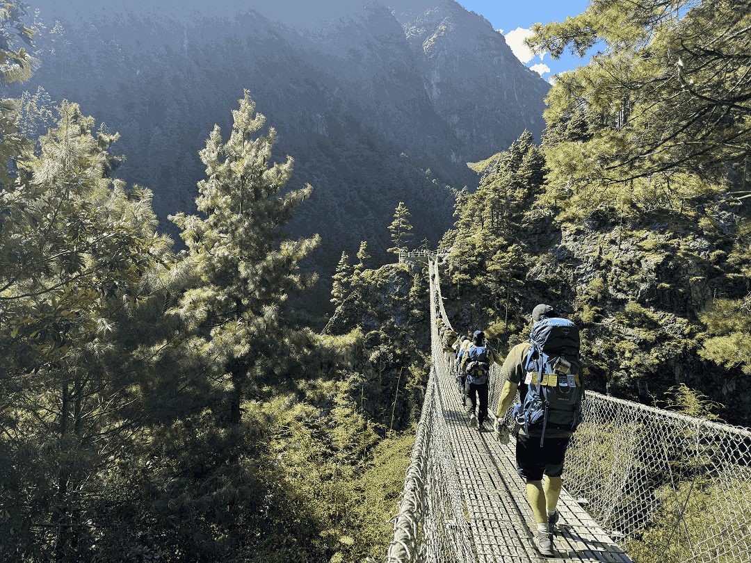
As you descend alongside the Dudh Koshi River, crossing swaying suspension bridges decorated with prayer flags, you’ll enjoy views of the turquoise waters and first sights of snow-capped peaks like Kusum Kanguru and Khumbila. The trail winds through rhododendron and pine forests, passing traditional Sherpa homes where you may see yaks and friendly locals.

Upon reaching Phakding, a peaceful riverside village, you’ll check into your lodge. You may visit the nearby Rimishung Monastery for a moment of reflection while acclimatizing for your adventures in Sagarmatha National Park.

Day 02 :

Trek from Phakding (2,610m / 8,563 ft) to Namche Bazaar (3,440 m / 11,286 ft)

Trek Distance

11 km/ 6.84 miles

Trek Duration

6-7 hours

Overnight Stay

Namche Bazaar

Highest Altitude

3,440 m / 11,286 ft (Namche Bazaar)

Meals

Breakfast, Lunch and Dinner

Accommodation

Teahouse

The second day in the Everest Three Passes Trek itinerary takes you from Phakding to the majestic Sherpa capital of Namche Bazaar. Along the way, you will pass through small hamlets like Toktok, Benkar, etc., where prayer wheels and mani walls are common along the way.

From Chumoa, you trek for about an hour until you reach Monjo, the entrance to Sagarmatha National Park. From here, the river gorge tightens between Monjo and Jorsalle, from where you will follow a shaded forest of pine and rhododendron.

After a short break in Jorsalle, the final stretch to Namche features several suspension bridges and culminates at the well-known Hillary Bridge, which is high above the river and covered with prayer flags. As the trail climbs steeply through the trees, you can see peaks like Thamserku and, on clear days, a view of Everest in the distance.

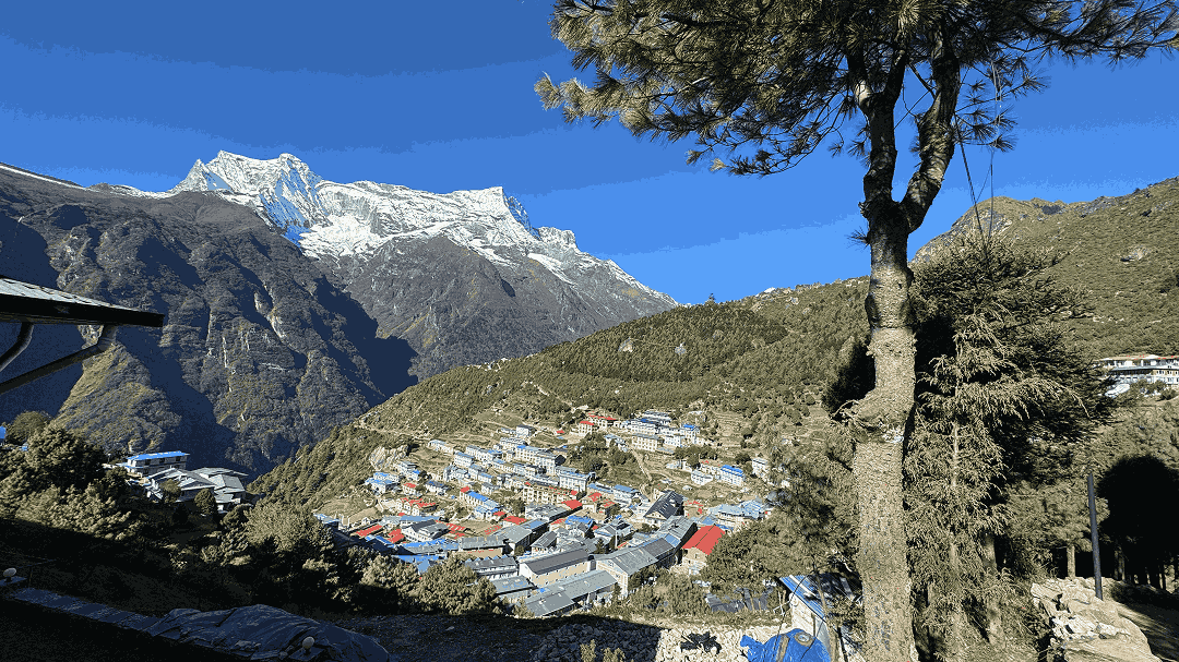
Eventually, the path levels off, and you reach the Namche police check post before entering Namche, a Sherpa town with stone houses, bakeries, and gear shops that serves as a hub for climbers heading to the high Khumbu. You will enter Namche, check into our lodge, and then stroll around pubs and bakeries, or simply engage with locals before dinner and sleep.

Day 03 :

Acclimatization at Namche Bazaar, side hike to Everest View Hotel (3,880 m / 12,730 ft)

Trek Distance

3.5 km/ 2.17 miles

Trek Duration

3-4 hours

Overnight Stay

Namche Bazaar

Highest Altitude

3,880 m / 12,730 ft (Everest View Hotel)

Meals

Breakfast, Lunch, and Dinner

Accommodation

Teahouse

The third day of the Three Pass trek is dedicated to acclimatization in Namche Bazaar. Namche is an ideal place for acclimatization, as it is well situated and offers ample facilities. Despite it being an acclimatization day, we will not stay on the usual itinerary; instead, we will take different side trips.

First, you travel to Syangboche airstrip, a grass runway on the hillside, where you might sometimes hear and see supply helicopters landing and taking off. From here, the trail continues along a path lined with blooming juniper and dwarf rhododendron, leading to Everest View Hotel. The Everest View Hotel is a high-elevation hotel renowned for its clear mountain views, along with hot drinks like Tea and Coffee.

We arrive at the hotel and then soak in the majestic mountain views. If there is time, we will extend your acclimatization hike towards the “Green Valley” villages of Khunde and Khumjung. ​Khumjung’s school, founded by Edmund Hillary’s Himalayan Trust, and a nearby monastery housing a Yeti relic, lend the area a sense of legend.

Khunde features the Hillary Hospital and a meditation cave linked to Guru Rinpoche. After completing the classic “hike high, sleep low” routine by returning to Namche, you can spend the evening exploring its narrow streets, chatting with Sherpa shopkeepers, or visiting the local museum to learn about the history of climbers and communities in the Khumbu.

Day 04 :

Trek from Namche (3,440 m / 11,286 ft) to Thame (3,800 m / 12,467 ft)

Trek Distance

9 km/ 5.59 miles

Trek Duration

5-6 hours

Overnight Stay

Thame

Highest Altitude

3,800 m / 12,467 ft (Thame)

Meals

Breakfast, Lunch, and Dinner

Accommodation

Teahouse

It’s time to move on from Namche and continue our Three High Passes journey. After leaving Namche, you first walk west along the beautiful Bhote Khosi River. The trail goes through beautiful pine trees, and you will see pink rhododendron flowers, if you are trekking in spring.

You will arrive in Phurte, renowned for its beautiful mud stupa, and then reach Thamo village, where the huge Thamo Gompa, an old monastery, is a major attraction. The trail then descends steeply when you arrive at a small power plant before reaching Thame.

Thame is a quiet, peaceful Sherpa village at the top end of the Khumbu Valley. Not many trekkers come here, so it feels special and calm. This village is known as the birthplace of Tenzing Norgay Sherpa, one of the first people to climb Everest. Despite being small, you can still visit an old monastery called Thame Gompa.

The Gompa features beautiful wall paintings and hosts an annual masked dance festival. You can meet friendly Sherpa families who live simply, care for yaks, and follow traditional Buddhist practices. It’s a great place to feel the quiet and peacefulness of Khumbu away from the crowds. Overnight stay in Thame.

Day 05 :

Trek from Thame (3,800 m / 12,467 ft) to Lungden (4,380 m / 14,370 ft)

Trek Distance

7 km/ 4.35 miles

Trek Duration

4-5 hours

Overnight Stay

Lungden

Highest Altitude

4,380 m / 14,370 ft (Lungden)

Meals

Breakfast, Lunch, and Dinner

Accommodation

Teahouse

You wake in Thame with a local breakfast and begin walking slowly up the quiet valley. The trail is easy, passing green meadows, small stone walls, and grazing yaks. You will see the beautiful sunlight early in the morning striking the rocks, colorful lichens, and huge snowy peaks like Ama Dablam and Tawoche against the blue sky. First, you pass through tiny settlements like Taranga, then Marulung at 4,200 m, a very peaceful spot with just a few lodges, houses, and prayer flags.

After trekking for about an hour from Marulung, you will reach a small remote settlement of Lungden at 4,380 m. The village is remote and far from everything, apart from views of majestic surrounding mountains. After settling in Lungden, you can take a side trip to Nakpa Valley if you have free time.


Day 06 :

Trek from Lungden (4,380 m / 14,370 ft) to Gokyo (4,790 m / 15,715 ft) via Renjo La Pass (5,360 m / 17,585 ft)

Trek Distance

11 km/ 6.84 miles

Trek Duration

7-8 hours

Overnight Stay

Gokyo

Highest Altitude

5,360 m / 17,585 ft (Renjo La Pass)

Meals

Breakfast, Lunch, and Dinner

Accommodation

Teahouse

Today is one of the most exciting days, as you will reach the first pass of the Three Pass Trek. You wake up early in Lungden and begin your long ascent towards Renjo La Pass. The trail is tough, climbing steadily through rocky paths, yak pastures, and old stone walls draped with prayer flags. As you keep climbing, the air feels thinner yet fresher.

You will then pass small frozen lakes before getting a majestic view of the Ngozumpa glacier. The path steepens near the top, but each step offers better views of major peaks, such as Cho Oyu ahead and the Rolwaling Mountains to the west. Reaching the top of Renjo La Pass at 5,360 m feels like a huge milestone.

From the top of Renjo La, you will get some of the iconic views of Khumbu, Mount Everest, Lhotse, Makalu, and Cho Oyu, along with bright purple Gokyo lakes shining far below another huge glacier. This spot was once part of an old trade route used by Sherpas to carry goods to Tibet.

After taking photos and resting, you head down the other side on a steep trail into a wild, empty valley. From here, the trail drops through open meadows and rocky slopes until you reach the peaceful villages of Gokyo, which is situated by the third lake. Here, you can check into your lodge and relax by the calm blue water, with an amazing view of Cholatse and Taboche above us.

Day 07 :

Acclimatization day in Gokyo, optional hike up to Gokyo Ri (5,357 m / 17,575 ft)

Trek Distance

6 km/ 3.7 miles

Trek Duration

5-6 hours

Overnight Stay

Gokyo

Highest Altitude

5,357 m / 17,575 ft (Gokyo Ri)

Meals

Breakfast, Lunch, and Dinner

Accommodation

Teahouse

The seventh day of the Everest Three Pass trek is another acclimatization day. It is essential to give your body time to adjust to the high-altitude weather and climate. The early-morning view of Gokyo village is majestic, thanks to the blue lakes and the prayer flags along the shore.

Today, you can stroll around the village and meet Sherpa families who run simple teahouses. You will also get to see yaks’ caravans passing through the village, and you can also take a slow walk around the lakes to find out how sacred this place is for locals.

Later in the day, you can also choose the hike up to Gokyo Ri, which is entirely optional. The climb to Gokyo Ri is for those who want to follow the “trek high, sleep low” principle, as it is a steep but straight climb. The top of the Gokyo Ri will reward you with astonishingly wide views of the mountains. As you gain height, the Ngozumpa Glacier appears below, a river of ice stretching into the distance, with Gokyo village becoming a tiny cluster of roofs beside the lake.

From the top, four peaks, Everest, Lhotse, Makalu, and Cho Oyu, form an arc, surrounded by lesser-known summits. After breathing in the cold air and enjoying the quiet, you head down to the village for a warm meal. You listen to stories from local Sherpas and trekkers as the last light fades.

Day 08 :

Trek from Gokyo (4,790 m / 15,715 ft) to Thangnak (4,750 m / 15,584 ft)

Trek Distance

4 km/ 2.49 miles

Trek Duration

3 hours

Overnight Stay

Thangnak

Highest Altitude

4,790 m / 15,715 ft (Gokyo Village)

Meals

Breakfast, Lunch, and Dinner

Accommodation

Teahouse

On the eighth day of the Three High Passes Trek, you will take a shorter walk from Gokyo to Thangnak. This walk lasts around 3-4 hours. You start by walking north along the shores of the third Gokyo Lake. The lake has bright turquoise water that shines in the sun, and you will see prayer flags waving gently.

Soon, the path climbs steeply up the side of the Ngozumpa Glacier, about 36 km long. From the top of this rocky ridge, you can view the Gokyo valley with its blue lakes and tall distant peaks like Cho Oyu. Next, you will walk down onto the glacier itself. The surface is wild and uneven, with loose rocks, dirt-covered ice, small frozen ponds, and ice tongues peeking out. Cairns mark the way to help you avoid getting lost on this changing landscape.

As you cross the glacier, the scenery is striking, with ups and downs over moraine humps and sandy flats. You might see small meltwater pools reflecting mountains like Taboche and Cholatse. After leaving the glacier, a short descent leads to the quiet ablation valley of Thangnak, a remote spot with a few simple lodges where Sherpa yak herders and guides rest.

Life here is basic: warm tea by the stove, shared stories, and the occasional sound of yak bells. This peaceful stop offers close-up glacier views and a calm break before tackling the steep Cho La Pass the next day, allowing you to experience the essence of the Himalayas.

Day 09 :

Trek from Thangnak (4,750 m / 15,584 ft) to Dzongla (4,830 m / 15,846 ft) via Cho La Pass (5,420 m / 17,782 ft)

Trek Distance

9 km/ 5.59 miles

Trek Duration

6-7 hours

Overnight Stay

Dzongla

Highest Altitude

5,420 m / 17,782 ft (Cho La Pass)

Meals

Breakfast, Lunch, and Dinner

Accommodation

Teahouse

The ninth day of the Everest Three Pass trek is another exciting day, as you will cross Cho La Pass. Today’s trek is quite tough, but equally rewarding, from Thangnak to Dzongla via Cho La Pass. It takes about 6–7 hours with big ascents and descents. The early trek involves a rocky ascent through loose boulders and icy patches.

The path passes small frozen lakes like Cho La Tsho, with bright blue water contrasting with dark rocks. As you climb, Ama Dablam rises to the south, and Cholatse stands sharply to the west. The final stretch involves scrambling over slippery sections and navigating crevasses. At the top, colorful prayer flags flutter on cairns, and the 360-degree views reveal peaks like Everest, Lhotse, and the Ngozumpa Glacier below.

After admiring the view from the pass, you start a long, careful descent on steep, rocky trails that can be slippery due to loose stones or ice. The trail drops through the barren moraine field with occasional glimpses of small meltwater streams and jagged ice features.

After a couple of hours, the route levels out into a peaceful valley of Dzongla. It is a small, quiet settlement of basic lodges along the hillsides, offering cozy spots with stoves and hot drinks. We stay overnight at Dzongla.

Day 10 :

Trek from Dzongla (4,830 m / 15,846 ft) to Lobuche (4,940 m / 16,207 ft)

Trek Distance

6 km/ 3.73 miles

Trek Duration

4 hours

Overnight Stay

Lobuche 

Highest Altitude

4,940 m / 16,207 ft (Lobuche)

Meals

Breakfast, Lunch, and Dinner

Accommodation

Teahouse

Today’s trek from Dzongla to Lobuche starts off mildly, with a clear trail along the hillside. You will get the long views of Ama Dablam and the Khumbu Glacier valley in the distance. As you walk above the dark, still waters of Cho La Tsho, the majestic blue lakes sit just below the steep rock walls.

Today, the route is fairly easy and almost flat, which lets you stop to admire views of Cholatse and Taboche and take wonderful photos. Even in this barren wilderness, you will find small stone yak shelters and scattered mani stones, which will remind you that life continues even in the harshest of conditions.

As we approach Lobuche, the landscape becomes a bit rougher and grayer. The sound of the Khumbu glacier goes silent, and Dzongla’s grassy slopes become quieter. Before reaching Lobuche village, we will make one final stop towards Thukla Pass, where lines of chortens and stone monuments honor climbers who died on Everest and nearby peaks.

Upon arriving in Lobuche, you step back onto the busy EBC route, sharing narrow lanes with porters, yaks loaded with supplies, and other trekkers. Lobuche holds quiet respect for being the highest settlement and final stop before the base of Mt. Everest.

Day 11 :

Trek from Lobuche (4,940 m / 16,207 ft) to Gorakshep (5,164 m / 16,942 ft), hike to Everest Base Camp (5,364 m / 17,598 ft), and return to Gorakshep

Trek Distance

15 km/ 9.32 miles

Trek Duration

6-8 hours

Overnight Stay

Gorakshep

Highest Altitude

5,364 m / 17,598 ft (Everest Base Camp)

Meals

Breakfast, Lunch, and Dinner

Accommodation

Teahouse

Today is quite the special day in our Three High Pass trail, as we reach the iconic Everest Base Camp. From Lobuche, the trail climbs slowly over the rocky trail beside the Khumbu Glacier. From here, you can see jagged ice towers and deep crevasses, which stretch far into the distance. The air is quite thin here, so hiking slowly and carefully is the best approach. Soon you will approach Gorakshep, a final settlement before Everest, which is surrounded by a small cluster of lodges.

After a short break in Gorakshep, you continue along a winding path that leads to Everest Base Camp. The EBC is a vast area, filled with rocks, ice, and colorful tents. The fluttering prayer flags around the base camp show the desire and bravery of many trekkers who have achieved one of their biggest milestones. In the distance, you will hear the sounds of ice shifting in the Khumbu Icefall.

Standing beneath the towering walls of Nuptse and the hidden summit of Everest, you will feel a blend of tranquility and emotion after days of trekking. So, savor the moment as much as you can before heading back to Gorakshep, tired but uplifted. Reaching Everest Base Camp will be your biggest achievement to date, due to the tough journey you experienced.

Day 12 :

Early morning hike to Kala Patthar (5,545 m / 18,192 ft) and trek to Lobuche (4,940 m / 16,207 ft)

Trek Distance

9.6 km/ 5.97 miles

Trek Duration

5 hours

Overnight Stay

Lobuche

Highest Altitude

5,545 m / 18,192 ft (Kala Patthar)

Meals

Breakfast, Lunch, and Dinner

Accommodation

Teahouse

After celebrating yesterday’s big achievement of reaching EBC, you will wake up in Lobuche with another big milestone in mind: reaching Kala Patthar. Kala Patthar is the highest elevation of the Khumbu region at 5,545 m. You will begin this climb, before dawn under a dark sky, guided by a narrow beam of headlamps in the cold, snowy path. As you reach higher, the mountain views of Pumori, Lingtren, and the long ridge of Nuptse become clearer.

If you are able to reach Kala Patthar, the view tower, before sunrise, you are in for a treat. A majestic golden sunlight reflects on snowy mountains, creating one of the most beautiful views you have ever witnessed.

After enjoying the views and taking photos, you descend to Gorakshep for breakfast and a rest before leaving. The return to Lobuche is easier, allowing you to spot details like frozen streams and glacial ponds. When you arrive, the lodges feel more inviting, filled with trekkers sharing stories with Sherpas and porters in a friendly atmosphere.

Day 13 :

Trek from Lobuche (4,940 m / 16,207 ft) to Chhukung (4,730 m / 15,518 ft) via Kongma La Pass (5,535 m / 18,160 ft)

Trek Distance

10.5 km/ 6.52 miles

Trek Duration

8 hours

Overnight Stay

Chhukung

Highest Altitude

5,535 m / 18,160 ft (Kongma La Pass)

Meals

Breakfast, Lunch, and Dinner

Accommodation

Teahouse

Another memorable day awaits us, as today you will reach the third pass of the Three High Pass Trek (Kongma La Pass). From Lobuche, your trail soon leaves the main Everest route and turns towards a wilder, quieter valley, where prayer flags and cairns guide your route instead of the lodges. As you climb higher towards Kongma La, the landscape changes completely into a world of frozen ponds, slate-colored rocks, and small patches of bluish ice that crack softly in the sun. The final stretch to the pass becomes tough due to thin air and steep paths. You will know when you have reached the top when you see the marker decorated with prayer flags and the famous wrapped crane figure.

From the top of the Kongma La, you will get wide and clear views of Lhotse, Makalu, Baruntse, and Ama Dablam stretching across the horizon. After soaking in the views, it’s time to descend from Kongma La, on steep and rocky trails that will lead you into the quiet Niyang Khola Valley. From here, you might see yak trails and old stone shelters used by Sherpa herders in the grazing season. As you descend, the path becomes easier and merges with a clearer trail that leads to Chhukung, a small settlement with lodges surrounded by open pastures. The sharp ridges of Island Peak and Lhotse guard this area. Many trekkers stop in Chhukung to rest and acclimatize. In the evening, the dining rooms fill with people who are planning climbs, checking maps, and sharing stories with local Sherpas. The Sherpas know every ridge and glacier in this hidden part of the Khumbu.

Day 14 :

Trek from Chhukung (4,730 m / 15,518 ft) to Pangboche (3,985 m / 13,074 ft)

Trek Distance

13 km/ 8 miles

Trek Duration

5/6 hours

Overnight Stay

Pangboche

Highest Altitude

4,730 m / 15,518 ft (Chhukung)

Meals

Breakfast, Lunch, and Dinner

Accommodation

Teahouse

From today, the descent starts. We wake up early in Chhukung. The trails begin with a gentle descent through open yak meadows, where you might see herders moving their animals or fixing their shelters before winter arrives. As we move towards Pangboche, we leave behind Lhotse and the ridges around Island Peak. You will see familiar peaks like Ama Dablam once again, from a different angle that shows new cliffs and hanging glaciers. The path passes near small resting spots with prayer flags and mani stones, reminding you that this high valley is not only a trekking route but also a spiritual place for the local people.

Further along, you once again rejoin the busier Imija Khola trail and head towards Dingboche. Here you will see long stone fences and potato fields, which reflect the Sherpa way of farming in this cold environment.

As you approach Pangboche, the scenery turns greener with dwarf juniper and birch. You’ll see more villages and monasteries in this lower region. Pangboche is one of the oldest Sherpa villages, featuring traditional houses, an important monastery, and narrow lanes where children play and trekkers relax in cozy lodges.

Day 15 :

Trek from Pangboche (3,985 m / 13,074 ft) to Namche Bazaar (3,440 m / 11,286 ft)

Trek Distance

14 km/ 8.7 miles

Trek Duration

6-7 hours

Overnight Stay

Namche Bazaar

Highest Altitude

3,985 m / 13,074 ft (Pangboche)

Meals

Breakfast, Lunch, and Dinner

Accommodation

Teahouse

Our high-altitude trek of the Three High Pass is coming to an end as we leave Pangboche. The trail initially follows the Imja Khola valley down through old stone houses and terraced fields. You will still get to see huge Ama Dablam behind you, and as you descend even more, the dry ground is replaced by dwarf rhododendron and juniper flowers. The landscape feels softer and greener than the high, rocky passes you crossed a few days ago. Along the way, you pass small chortens and mani walls carved with prayers, and there are a few quiet tea houses where you can stop for tea while watching long lines of yaks and porters move supplies up toward the higher villages.

The trail keeps dropping down the river and crosses one or two suspension bridges decorated with prayer flags. After climbing back up, through pine and fir forests, you re-enter the valley that goes towards Namche Bazaar. From here, the trail becomes busier with returning trekkers and locals heading to the market. Arriving at Namche feels like a blessing, since it is the only developed settlement around. You will spend the night in Namche Bazaar.

Day 16 :

Trek from Namche (3,440 m / 11,286 ft) to Lukla (2,860 m / 9,383 ft)

Trek Distance

15 km/ 9.32 miles

Trek Duration

8 hours

Overnight Stay

Lukla

Highest Altitude

3,440 m / 11,286 ft (Namche Bazaar)

Meals

Breakfast, Lunch, and Dinner

Accommodation

Teahouse

After spending your night in Namche, it’s time to move on. From Namche, the trail drops steadily through pine and juniper forest. The expansive views of Kongde Ri and Thamserku, fading behind the terraced houses, make for quite a view. As you pass the checkpost and follow the path to Larja Dobhan, the sound of the Dudh Koshi River grows louder. Small chortens, mani stones, and prayer flags mark the trail, highlighting its significance to the local Sherpa communities. After reaching Monjo and Jorsalle, you exit Sagarmatha National Park and cross suspension bridges. You may see Himalayan birds along the way to the riverside lodges in Phakding, where the lower altitude and cozy dining rooms offer a welcome comfort after days in the thin air.

After taking a break in Phakding, we begin moving gently through the path that follows the Dudh Koshi river. You will first pass small villages like Ghat and Chhuthawa, where stone walls, painted mani boulders, and spinner prayer wheels sit beside teahouses. To reach Lukla, we have to climb a steady uphill stretch. Soon, you will hear the sound of aircraft from Tenzing-Hillary Airport mix with the bells of dzopkyo and yaks moving along the main street. You will enter Lukla through the Pasang Lhamu memorial gate. From here, you will trek through narrow stone-paved lanes lined with lodges, gear shops, and cafes. In the evening, we will celebrate the end of the Three High Passes journey and say thank you to everyone who helped us achieve this.

Day 17 :

Fly from Lukla (2,860 m / 9,383 ft) to Kathmandu (1,324 m / 4,343 ft) / Manthali (474 m / 1,555 ft)

Overnight Stay

Kathmandu

Drive Duration

5 hours

Flight Hours

40 minutes (Kathmandu)/ 20 minutes (Manthali)

Meals

Breakfast, Lunch, and Dinner

Accommodation

Teahouse

Today marks the end of your Everest 3 Passes Trek. You have two flight options: one back to Kathmandu, which takes about 30-45 minutes, or a flight to Manthali. If you choose Manthali, you’ll have a short 20-minute flight, followed by a 4 to 6-hour drive to Kathmandu. The choice between landing in Kathmandu or Manthali depends on the season and weather, and whether Kathmandu airport is busy with international flights. We hope you enjoyed our Everest Three High Pass trek and see you on your next adventure.

Note: The flight can be directed to either KTM or Manthali, depending on the season.

Three High Passes Trek Includes

  • Private vehicle pick-up and drop-off service between Kathmandu Airport and your hotel.
  • Round flight from Kathmandu/ Manthali to Lukla and vice versa.
  • Accommodation during the trek (15 nights).
  • Standard meal (17 breakfasts, 17 lunches, and 17 dinners).
  • One government-licensed and English-speaking trek guide.
  • Porter (1 porter for 2 trekkers), max weight limit is 18 kg (9 kg per trekker).
  • Wages, lodges, meals, insurance, transportation, flights, and equipment for guides and porters are included.
  • Trek permits (Sagarmatha National Park Entry Permit + Khumbu Pasang Lhamu Rural Municipality Entrance Permit).
  • Farewell dinner at the end of the trek.
  • Sleeping bags, down jackets, and a duffel bag (one for every two trekkers).
  • All government, local taxes, and official expenses.

Three High Passes Trek Excludes

  • International flight and visa.
  • Accommodation in Kathmandu.
  • All meals in Kathmandu, before and after the trek.
  • Travel insurance.
  • Tips for guides, porters, and staff.

Departure Dates

Set off on your next adventure with our scheduled departures and easy per-person pricing. Meet like-minded travelers, share the journey, and create stories worth telling. Just pick your date, and we’ll take care of the details.

17 Days

Trip Days

27 Oct, 2026

Start Tuesday

12 Nov, 2026

End Thursday

0

Pax Booked

15

Group Size

USD 1,300

Price

Booking Open

Status

Make Your Journey Private

Experience Nepal exactly the way you imagined it. Our private trips are crafted with complete flexibility with your dates, your pace, your preferences. Whether you want a slow cultural immersion, a scenic road journey.

Additional Information:

Moraine Trails, Remote Valleys, Everest Base Camp, and Kala Patthar: What To Expect?

The Everest Three High Pass Trek is distinct from other treks in Nepal. In this trek, the moraine trails and remote valleys surrounding it give the whole adventure a strong sense of remoteness and wilderness. The glacial moraines around Khumbu that approach the high passes (such as Kongma La and Cho La) are rocky, uneven, and often feel like hiking through a frozen stone desert. Here, you can expect slow, careful footwork and constantly changing underfoot conditions. These sections connect familiar villages to quiet valleys, with wide U-shaped glacial basins and occasional wind and distant avalanches. Trekking in remote areas is more adventurous than the usual Everest Base Camp route. Key factors include altitude, weather, and the need for self-sufficiency.

​Everest Base Camp and Kala Patthar are key landmarks in the Khumbu region. They sit at the emotional point of the Three High pass circuit, as each destination feels like a milestone. Everest Base Camp is the starting point for climbing the world’s highest peak. Here, you find tents and prayer flags at the foot of the Khumbu Icefall. Although you can’t see the summit of Everest from here, this site is key for those planning to attempt the climb.

Kala Patthar is both a unique and a common destination. It is a steep pre-dawn climb that offers unobstructed views of the entire Everest massif and neighbouring peaks such as Nuptse, Lhotse, and, in the distance, Mount Makalu. You will experience the Three High Pass route, which combines a tough moraine trek, quiet high valleys, and iconic views of EBC and Kala Patthar, making the trek feel like a complete Everest experience.

Lesser-Known Challenges of the Three High Passes Trek

Everest Three High Passes Trek is often described as “hard but manageable with fitness”. However, there are several lesser-known challenges to this trek beyond steep climbs or thin air. Beyond the tough terrain and high altitude risks, this adventure exposes you to other underrated challenges, including microclimates, cumulative exhaustion, and psychological wear from poor sleep, isolation, and a fading appetite. You must be prepared for these challenges rather than surprised.

Microclimates are small, localized weather patterns that can differ significantly from the surrounding areas. These weather patterns along the Three Passes route can cause rapid changes, even when the overall forecast is stable. Narrow valleys and shaded slopes can trap cold air, resulting in sudden ice, strong winds, or fog that limits visibility on one side of a pass. Trekkers may experience sun, wind, and even snow in a single day, complicating layering and increasing the risk of chills, which can drain energy and morale before severe weather hits.

Spending days above 4,500 m means the body gets only about half the oxygen available at sea level. Recovery between climbs is incomplete, making each ascent feel tougher, even for experienced trekkers. By the third pass, some may experience chronic altitude symptoms, such as headaches, poor sleep, and loss of appetite, which can lead to a “wired but empty” feeling and an increased risk of accidents on challenging terrain.

Sherpa Villages, Monasteries, and the Himalayan Lifestyle

Sherpa Villages are quite common along the Everest Three High Pass Trek. The settlements like Namche Bazaar, Thame, Dingboche, and Gokyo village blend traditional stone houses, yak pastures, potato fields, and modern teahouses that are helpful to trekkers but still reflect a Himalayan life hundreds of years old. Mani walls, chortens, and carved prayer stones are common highlights of Sherpa villages, often perched on sunny terraces above glacier-fed rivers like the Dudh Koshi, with views of majestic peaks such as Everest, Ama Dablam, and Thamserku. These settlements serve as cultural centers and places for visitors to adjust to the high altitude. Visitors can meet Sherpa families, try local food, and see how trekking and climbing contribute to the local economy, while farming and herding continue nearby.

You will find different monasteries throughout the trek of the Everest Three High Passes, like Khumjung, Tengboche, and Pangboche. These monasteries are very important to the spiritual life of the Khumbu region. Various rituals and pujas are held in these monasteries, along with major festivals such as Mani Rimdu and Dumji. During these festivals, people dance in masks, chant, and offer blessings, connecting their daily lives to Tibetan Buddhist traditions. Trekkers see prayer flags over passes and bridges, spin prayer wheels in village centers, and walk clockwise around mani walls. This spiritual presence follows them from Lukla to the highest passes.

The Himalayan lifestyle in the Everest region is quite tough. It is shaped by altitude, climate, and faith, producing a life built around farming, yak herding, trading, and seasonal work in lodges or as guides and porters. Their homes are simple but sturdy, with smoky kitchens, family altars, and storerooms for barley, butter, and potatoes. In high altitude, there are several teahouses in the slopes of hills. In the Gokyo valleys, glaciers surround sacred lakes that people believe are home to deities. Life here is hard but very communal. Visitors can feel this sense of community in shared dining rooms, where local climbers tell stories about climbing Everest. The mountains are seen not just as challenges to be conquered but as gods deserving respect.

Things People Ask About Three High Passes Trek

Travel Tips, Stories, & Guides

Travel guides, trekking stories, and blogs from Outbound Treks.

Connect with Hari Gurung

Your Trek Starts with a Conversation

Our founder started working as a porter at 17. Today, he leads a local trekking team with nearly 15 years of guiding experience. We know these trails through years of work, and we’d love to help you plan your trek in Nepal.